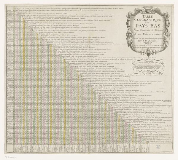
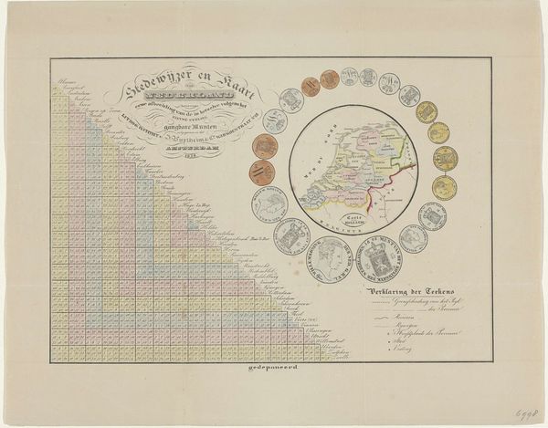
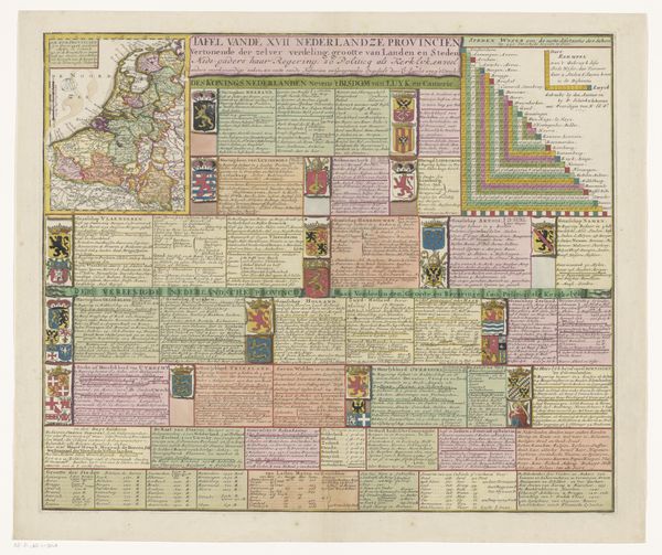
Afstandstabel voor de belangrijkste steden van de 17 Nederlandse Provinciën 1731
0:00
0:00
jacobkeyser
Rijksmuseum
graphic-art, print, engraving
#
graphic-art
#
narrative-art
#
dutch-golden-age
# print
#
geometric
#
line
#
engraving
Dimensions: height 181 mm, width 200 mm
Copyright: Rijks Museum: Open Domain
This is Jacob Keyser's "Afstandstabel voor de belangrijkste steden van de 17 Nederlandse Provinciën," a chart of distances between cities in the Dutch provinces. What immediately strikes the eye is the grid-like arrangement of the cities and numbers, presented with a colourful bar graph to explain the distances. There is a visual clarity that borders on abstraction. The composition is structured as a functional yet aesthetically pleasing set of visual information, challenging traditional map-making conventions through a semiotic system of signs to represent geographical data. The grid organizes space to challenge fixed meanings. The map's geometric shapes, along with the strategic use of line and colour, serve to deconstruct traditional notions of mapping. It is challenging the viewer to reconsider how cartographic information can be both visually engaging and intellectually stimulating.
Comments
No comments
Be the first to comment and join the conversation on the ultimate creative platform.
More like this