print, engraving
# print
#
geometric
#
history-painting
#
engraving
Dimensions: height 600 mm, width 525 mm
Copyright: Rijks Museum: Open Domain
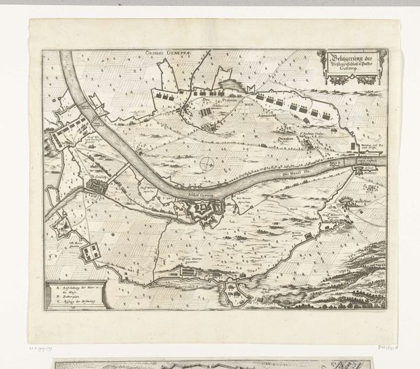
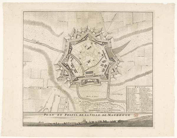
Editor: So, here we have "Ligging van de Geallieerden bij het beleg van Douai, 1710," a print, an engraving to be exact, by Pieter van Call the Younger. It details the Allied camp during the siege of Douai. It strikes me as less of an artwork and more of a historical document. What’s your take? Curator: It's tempting to view it solely as documentation, but I think that would overlook the crucial ways these images helped shape and propagate narratives around war and power. It's not a neutral record, but a carefully constructed account meant to legitimise and celebrate specific power dynamics. Editor: Could you elaborate? What dynamics are being celebrated here? Curator: Consider who commissioned and consumed these prints. They offered a vision of war through a particular lens, omitting certain truths while highlighting strategic successes. Whose perspectives are privileged? Are there marginalized voices conspicuously absent from this visual representation of the siege? Editor: I see what you mean. It makes me consider how this print functioned in building national identity and solidifying power structures. How did it contribute to public perception of the war? Curator: Exactly! And who benefits from that perception? Remember, images can be tools for persuasion and control. Think about how the map positions Douai in relation to the "Allied" forces and their enemies. What assumptions does it invite us to make about whose cause is just? Editor: I never thought about a map offering an opinion. So looking at the way the camps are positioned and labelled, the choice of font and the overall aesthetic becomes a deliberate act of shaping the historical narrative…it is about power after all! Curator: Precisely. And that realization challenges the traditional idea of "history-painting", suggesting a critical questioning of power structures. It's about reading between the lines – or, in this case, between the lines of the map!
Comments
No comments
Be the first to comment and join the conversation on the ultimate creative platform.
More like this