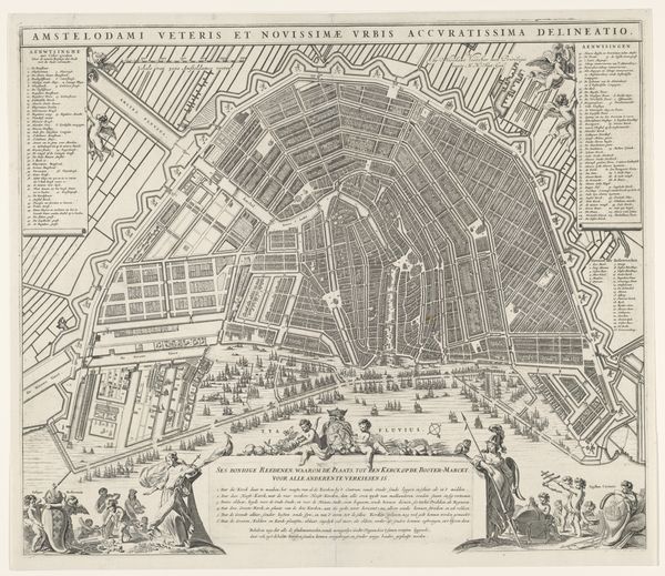
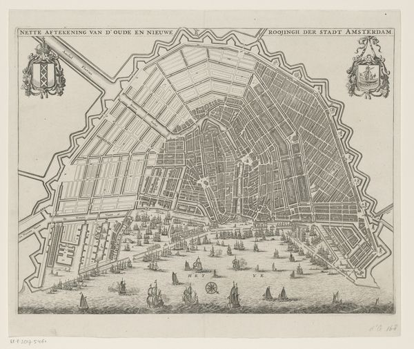
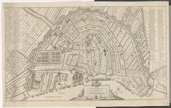
Plattegrond van Amsterdam met stadsgezicht en ontwerp voor de Vierde Uitleg 1662 - 1664
0:00
0:00
pieterhendrickszschut
Rijksmuseum
graphic-art, print, engraving
#
graphic-art
#
dutch-golden-age
# print
#
old engraving style
#
landscape
#
ink line art
#
cityscape
#
engraving
Dimensions: height 492 mm, width 580 mm
Copyright: Rijks Museum: Open Domain
This is Pieter Hendricksz. Schut’s “Plattegrond van Amsterdam met stadsgezicht en ontwerp voor de Vierde Uitleg,” a detailed map of Amsterdam. It’s made with engraving, a printmaking technique that involves incising lines into a metal plate, inking it, and then pressing it onto paper. Look closely at the incredibly fine lines, and the sheer density of information that the artist has packed in. This wasn’t just a way of documenting the city. It was a tool for the administration of capital. Each individual parcel of land, each building, represents an economic opportunity. The very act of engraving mirrors the planned, rational structure of the city itself. Schut's skill in engraving transforms the layout of Amsterdam into something that is not only informative but also aesthetically pleasing. This combination of technical skill, artistic vision, and the underlying economics of land and property, are what makes this map more than just a map. It’s a window into the ambitions and values of a society on the rise.
Comments
No comments
Be the first to comment and join the conversation on the ultimate creative platform.
More like this