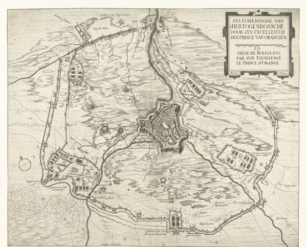
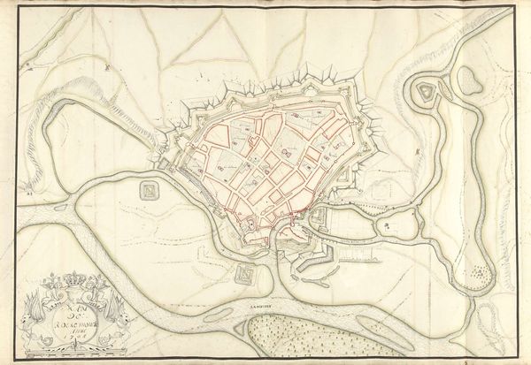
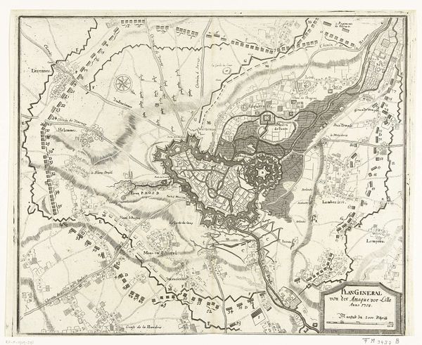
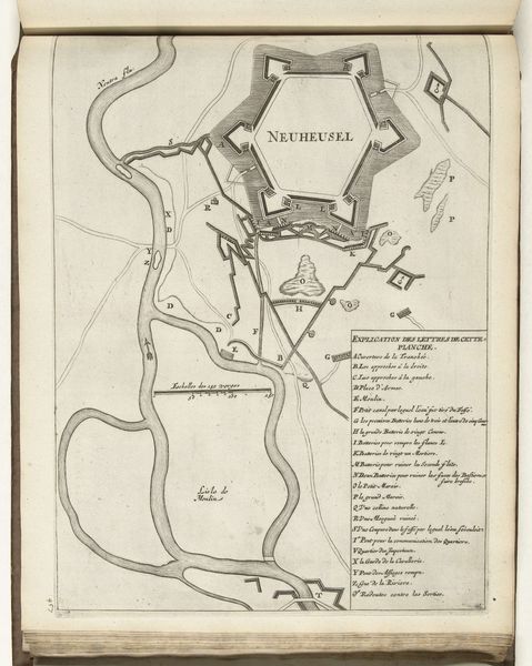
Kaart van het beleg van Den Bosch door Frederik Hendrik, 1629 1629 - 1631
0:00
0:00
anonymous
Rijksmuseum
#
comic strip sketch
#
old engraving style
#
personal sketchbook
#
idea generation sketch
#
sketchwork
#
pen-ink sketch
#
pen work
#
sketchbook drawing
#
storyboard and sketchbook work
#
initial sketch
Dimensions: height 355 mm, width 422 mm
Copyright: Rijks Museum: Open Domain
This map, made in 1629 by an anonymous artist, depicts Frederik Hendrik's siege of Den Bosch. The formal qualities of the map, particularly its emphasis on structure, and precise linework, reveal a worldview deeply rooted in order and strategic planning. The composition is dominated by a series of geometric forms: the intricate layout of Den Bosch itself, surrounded by a network of fortifications and waterways, each meticulously rendered. The use of line is particularly striking. Fine, precise lines delineate buildings, streets, and defensive structures, creating a sense of clarity and control. The map transcends mere cartography, functioning as a symbolic representation of power and knowledge. It embodies the era's confidence in rational thought and the ability to impose order upon the world. It invites us to consider how these formal elements reflect larger philosophical concerns about control, strategy, and the representation of space during a time of conflict.
Comments
No comments
Be the first to comment and join the conversation on the ultimate creative platform.
More like this