drawing, print, etching, ink
#
drawing
#
medieval
#
pen drawing
# print
#
etching
#
landscape
#
ink
#
geometric
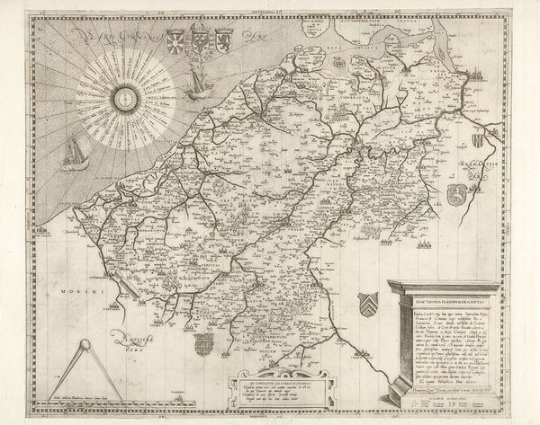
Dimensions: height 390 mm, width 515 mm
Copyright: Rijks Museum: Open Domain
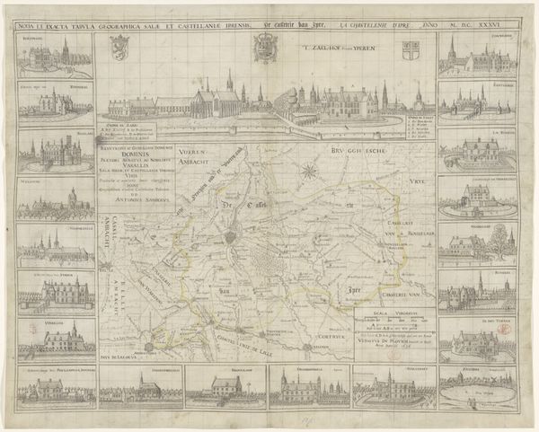
This is Jodocus Hondius's map of Surrey, made in 1598, meticulously etched with topographical and heraldic details. Notice the compass rose, an emblem that transcends mere navigation; it's a visual anchor, deeply rooted in humanity's quest for orientation. The compass, akin to the wheel or cross, persists through epochs, echoing in both sacred mandalas and secular emblems. Its form is imprinted upon our collective psyche, representing not only direction but also destiny and the cyclical nature of existence. We see it in the labyrinth, a symbol of life’s intricate path, which has manifested in classical times and medieval cathedrals. This cartographic symbol, therefore, becomes more than a tool; it serves as a conduit to unconscious desires, a projection of our relentless yearning to chart both external landscapes and internal worlds. It's a powerful psychological symbol, embodying both our desire to explore and our need for a fixed point in an ever-changing world. Its recurring presence in art and culture reveals its timeless appeal to the human psyche.
Comments
No comments
Be the first to comment and join the conversation on the ultimate creative platform.
More like this