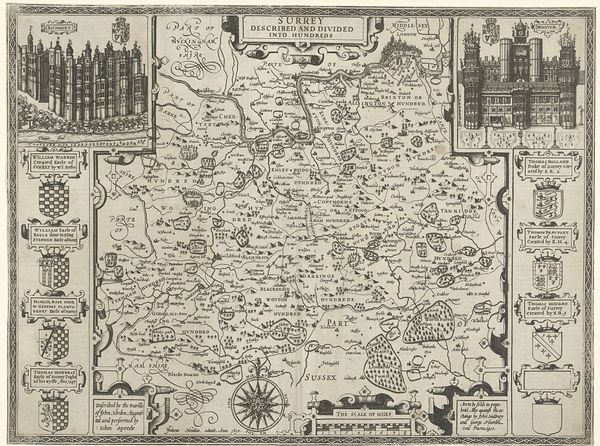
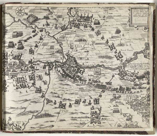
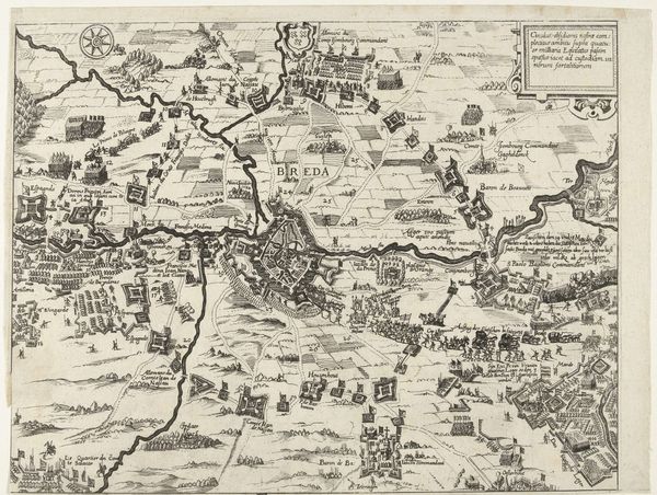
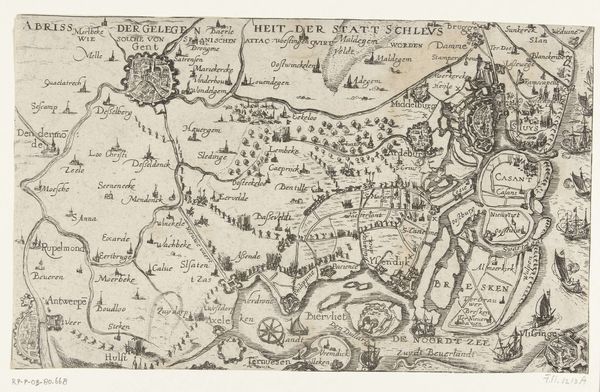
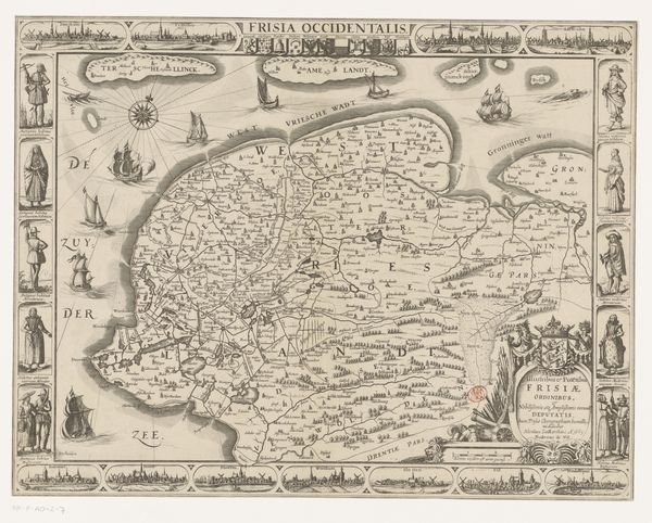
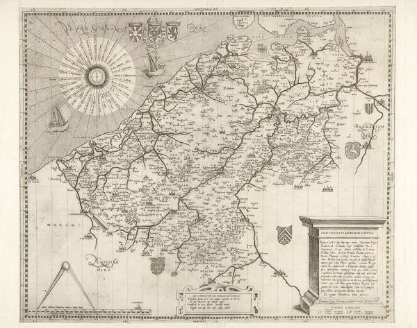
drawing, print, paper, ink, engraving
drawing
medieval
perspective
paper
ink
geometric
cityscape
engraving
Dimensions: height 390 mm, width 515 mm
Copyright: Rijks Museum: Open Domain
Curator: Looking at this print, “Kaart van Middlesex” created by Jodocus Hondius in 1610, I am immediately struck by the density of information, almost overwhelming to the eye. What stands out to you? Editor: The lines are so clean, despite the intricate details. It is more than a representation of geographic space; this engraving becomes an act of production of place itself, the making of Middlesex, in its image, known by those seeing this. Curator: Exactly, the printing process itself is crucial. The engraving, the ink, and the paper all contribute to this construction of "Middlesex." It’s fascinating to think about the socio-economic factors involved – the availability of materials, the skill of the craftsman, and the market for maps at this time. Editor: Observe how the rendering of St. Paul's or Westminster Abbey turns the structure into an image. Each element works according to compositional strategies of the picture plane; line and form work to convey three-dimensional buildings, but ultimately we are viewing shapes on paper. The artist’s hand mediates space through design. Curator: And that design was serving a purpose. Hondius was part of a thriving map-making industry catering to explorers, merchants, and landowners. Maps like these weren't just decorative; they were tools embedded within colonial aspirations and growing trade networks. Note too how "The most famous cities of London and Westminster" is stated as such - making it 'real', 'famous'. Editor: True, but its enduring power lies in its composition—the geometric structure, the contrast between densely packed areas and more open spaces. It shows the world in a framework, according to lines and divisions on the page. Curator: I agree that the form guides the impact of the object but think it critical not to divorce the aesthetic experience from its status as a commercial object reflecting and shaping its time. These were more than objects; they were active agents. Editor: And therein, I would agree, lies their enduring artistic statement.
Comments
No comments
Be the first to comment and join the conversation on the ultimate creative platform.
More like this