print, engraving
baroque
geometric
cityscape
history-painting
engraving
Dimensions: height 515 mm, width 550 mm
Copyright: Rijks Museum: Open Domain
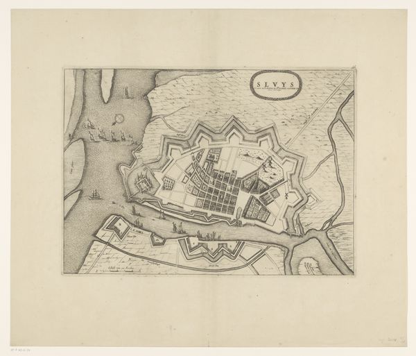
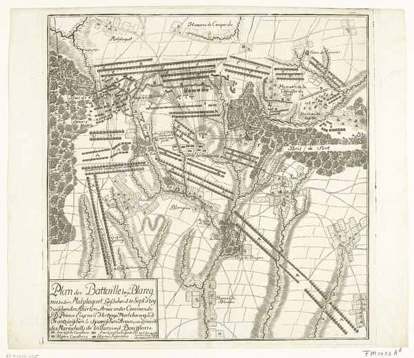
Pieter van Call the Younger created this print of the Siege of Béthune in 1710. It provides a bird's-eye view of the city's fortifications during the War of the Spanish Succession, a conflict that reshaped European power dynamics. Published in the Netherlands, this print reflects the Dutch Republic's significant role in the war and its interest in documenting military campaigns across Europe. The map meticulously details the siege works, revealing the strategies employed by the Allied forces against the French-held city. The key at the bottom serves not only as a guide but also as a form of propaganda. It subtly showcases the technological prowess and strategic thinking of the besiegers. Historical prints like these offer valuable insights into the military, political, and social contexts of their time. By consulting period documents, military treatises, and diplomatic correspondence, we can better understand the complex web of power and influence that shaped the early 18th century.
Comments
No comments
Be the first to comment and join the conversation on the ultimate creative platform.