print, paper, ink, engraving
#
dutch-golden-age
#
ink paper printed
# print
#
landscape
#
paper
#
ink
#
pen-ink sketch
#
engraving
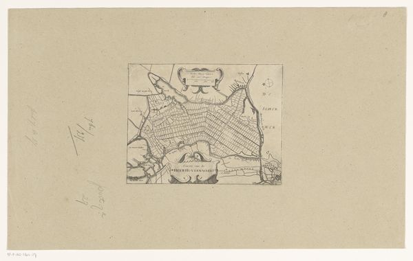
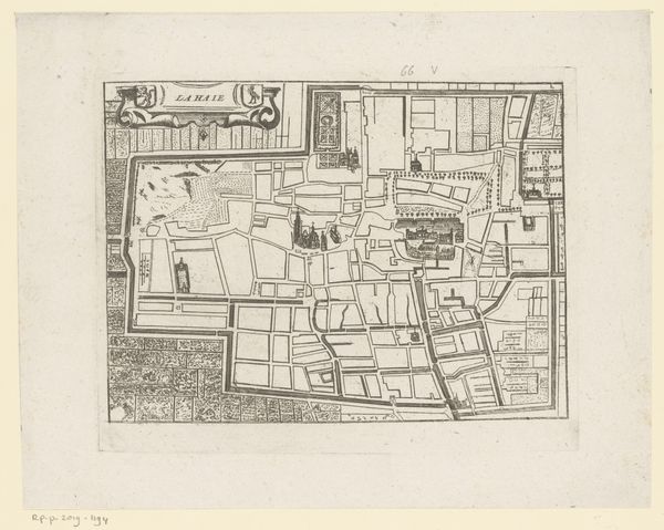
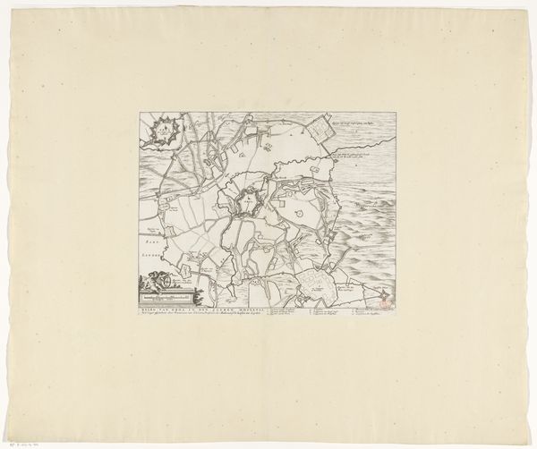
Dimensions: height 157 mm, width 180 mm
Copyright: Rijks Museum: Open Domain
This is an anonymous map of the Starnmeerpolder plots, created in 1643. This map offers a glimpse into the ambitions and structures of the Dutch Golden Age. It reflects the Dutch Republic's innovative approach to land reclamation, transforming a large lake into fertile land for agriculture and settlement. The rigid, geometric organization of the lots speaks to a culture deeply invested in order, control, and the exploitation of natural resources. Who decided who got which plot, and what does that tell us about the power structures of the time? The map’s aesthetic precision belies the profound ecological transformation it represents and the impact on the lives of those who would work this land. Consider the stories of the individuals and families who would have inhabited this newly-formed space. This map is not merely a representation of land, but a document of human intervention and aspiration, raising essential questions about our relationship to the environment.
Comments
No comments
Be the first to comment and join the conversation on the ultimate creative platform.
More like this