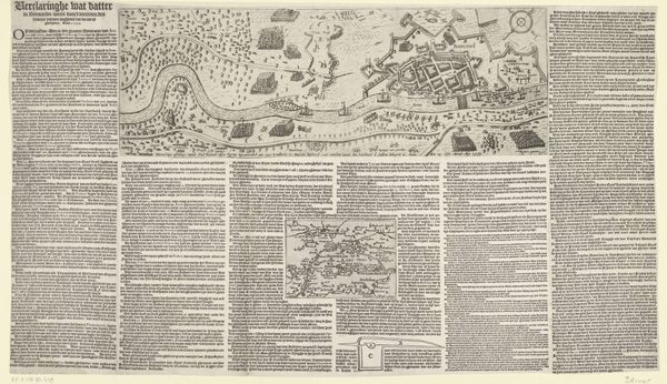
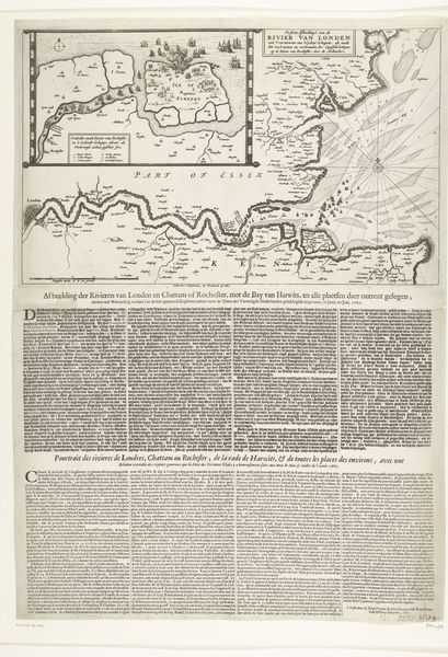
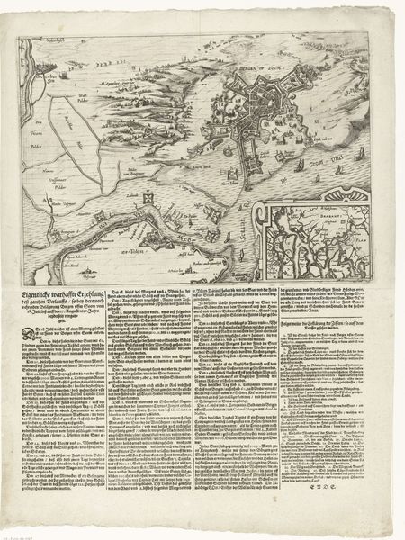
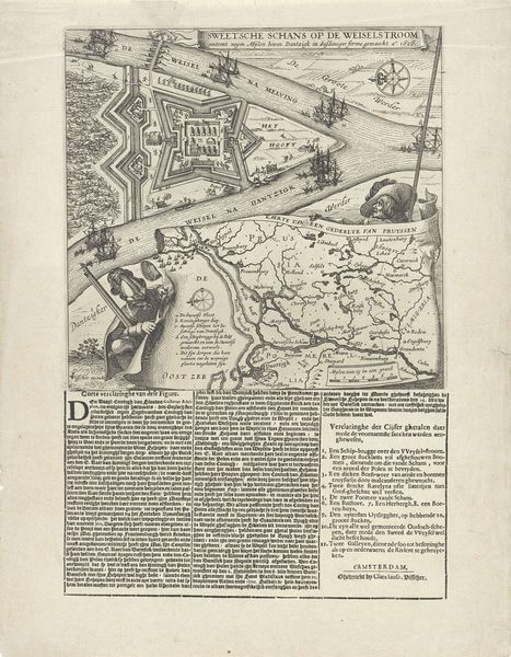
print, engraving
#
baroque
# print
#
landscape
#
cityscape
#
history-painting
#
engraving
Dimensions: height 540 mm, width 389 mm
Copyright: Rijks Museum: Open Domain
Editor: This is an engraving from 1640, titled "Siege and conquest of Arras by the French" and made by an anonymous artist. It feels very much of its time, like a news report combined with a strategic map. What do you see in this piece? Curator: Well, immediately I see how potent the visual language of cartography was and still is. Maps aren't just about spatial relationships; they are loaded with cultural meaning. The visual vocabulary – the way power, conquest, and territory are represented – this informs the cultural memory surrounding this event. Editor: That's fascinating. So even a map like this one carries a sort of propaganda? Curator: Absolutely. Consider the symbols chosen: the French rooster crowing over what? What does the rooster itself stand for, culturally? And observe how the artist contrasted it with symbols alluding to the defeated Spanish troops. This print functions on multiple layers, as both document and declaration. We still respond to those coded images, even if unconsciously. Do you think the choice to include text with detailed 'explanations' reinforces its function as more than simply a representation of a conquest? Editor: Definitely. The amount of text almost overwhelms the image, which underscores the need to control the narrative, not just the territory. So the visual elements, together with textual explanation, amplify the message. It’s all very intentional, isn’t it? Curator: Precisely. It reminds us that even seemingly objective depictions are shaped by the artist’s, and the patron's, intent, echoing through history and continually informing how we understand this historical moment. Editor: I never would have considered that level of coded messaging within a map before. This piece has really shifted my understanding.
Comments
No comments
Be the first to comment and join the conversation on the ultimate creative platform.
More like this