graphic-art, print, engraving
#
graphic-art
#
dutch-golden-age
# print
#
old engraving style
#
river
#
cityscape
#
engraving
Dimensions: height 213 mm, width 225 mm, height 390 mm, width 304 mm
Copyright: Rijks Museum: Open Domain
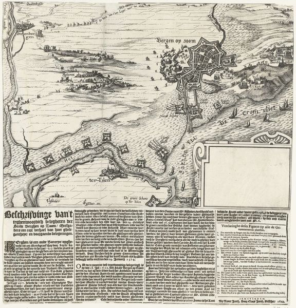
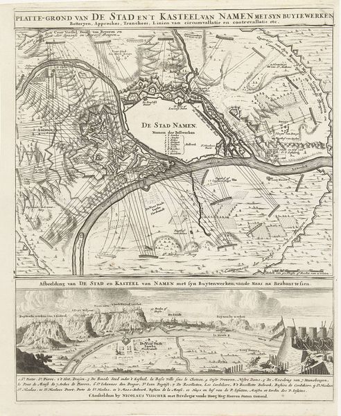
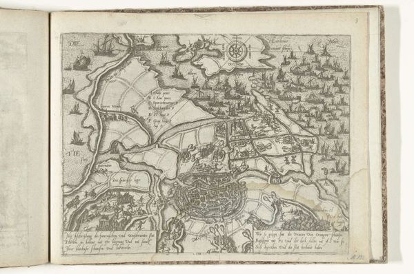
Claes Jansz. Visscher produced this print, "Plattegrond van Gdańsk," in the Netherlands, sometime between the late 16th and mid-17th centuries. The map depicts Gdańsk, now in Poland, with the river Vistula running through it and details the fortifications around the city. During this period, cartography had become crucial to Dutch commercial and military interests, and prints like this served multiple purposes. Visscher's detailed rendering emphasizes the strategic importance of Gdańsk as a Baltic port city. Note how the city's defenses are highlighted, reflecting the political tensions and the need for secure trade routes. The inclusion of text further explains the features of the city. Such historical maps provide valuable insights into the geopolitical landscape of the time and the role of cities within larger power structures. To understand this print better, it’s important to consider the Dutch Golden Age and the nation's interest in trade and military strategy. Investigating archives, period documents, and other maps can provide a broader view of its social and institutional context.
Comments
No comments
Be the first to comment and join the conversation on the ultimate creative platform.
More like this