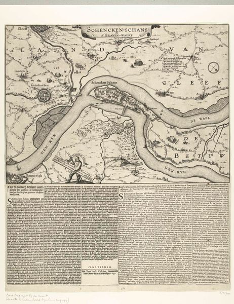
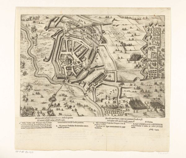
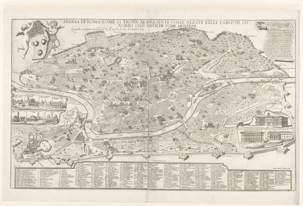
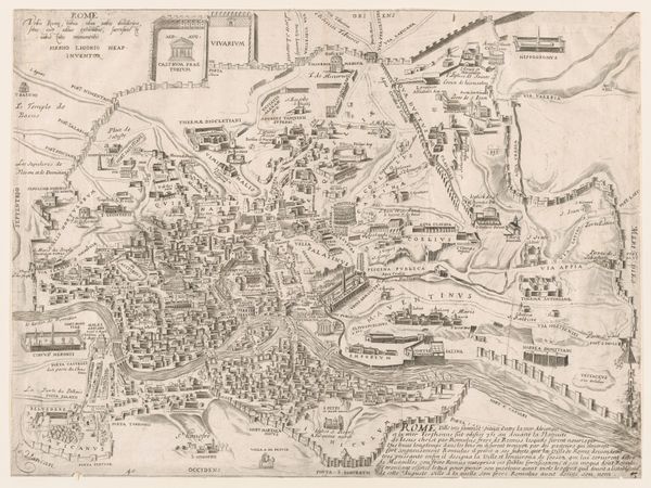
drawing, print, ink, engraving
#
drawing
# print
#
landscape
#
perspective
#
ink
#
geometric
#
14_17th-century
#
engraving
Dimensions: height 455 mm, width 388 mm
Copyright: Rijks Museum: Open Domain
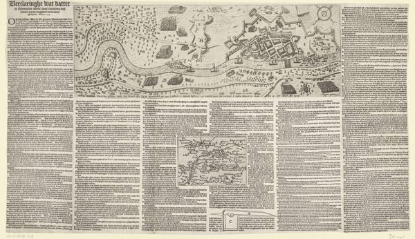
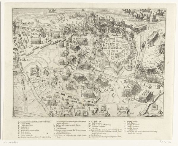
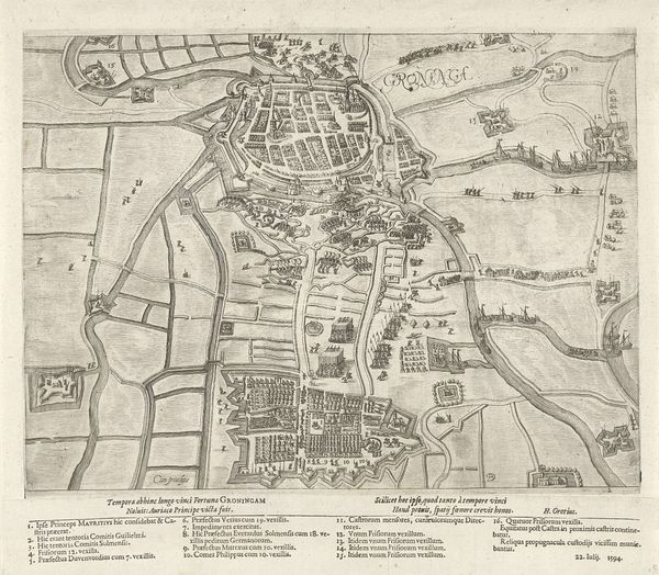
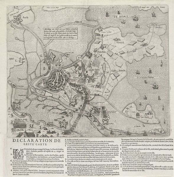
Baptista van Doetechum made this print, "Bestorming van Oostende," in 1602, and it depicts the siege of Ostend, a pivotal event in the early stages of the Eighty Years' War between the Dutch Republic and Spain. Maps like this one served a crucial public role in the 17th century. More than just geographic tools, they were instruments of power and propaganda. Produced in the Netherlands, this map emphasizes the Dutch perspective on the conflict, visually celebrating their resilience against Spanish forces. The detailed depiction of military fortifications, troop movements, and naval activity creates a narrative of Dutch resistance, shaping public opinion and bolstering national identity. To fully understand this image, we need to delve into historical archives, military records, and political pamphlets of the period. These sources can help us to appreciate the political significance that such images held in shaping the European socio-political landscape.
Comments
No comments
Be the first to comment and join the conversation on the ultimate creative platform.
More like this