graphic-art, print, ink, engraving
#
graphic-art
#
baroque
#
dutch-golden-age
# print
#
pen sketch
#
landscape
#
ink
#
geometric
#
line
#
engraving
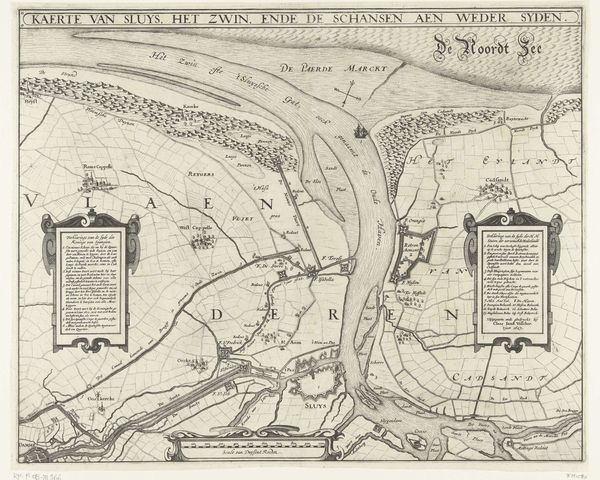
Dimensions: height 463 mm, width 350 mm
Copyright: Rijks Museum: Open Domain
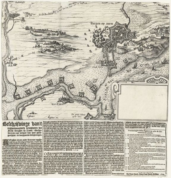
This is an anonymous print from 1667, depicting the Thames Estuary and the Medway during the Dutch raid on Chatham. The eye is immediately drawn to the intricate lines tracing the waterways, dividing the land into discernible, labeled segments. The overall texture appears almost topographical, as the layering of information creates a dense, varied surface. The map’s structure, with its detailed rendering of geographical features, presents itself as an objective document. However, the very act of mapping, of imposing a grid and labeling places, reveals an assertion of control. This reflects the historical context of territorial disputes and the use of cartography as a tool of power. The map is not just a representation, it is a performance, actively shaping how one perceives and relates to the space. Ultimately, this print prompts us to consider how we construct and interpret the world through visual representations. It is a stark reminder that what we see is always mediated, framed, and imbued with layers of meaning.
Comments
No comments
Be the first to comment and join the conversation on the ultimate creative platform.
More like this