graphic-art, print, engraving
#
graphic-art
#
baroque
# print
#
old engraving style
#
cityscape
#
engraving
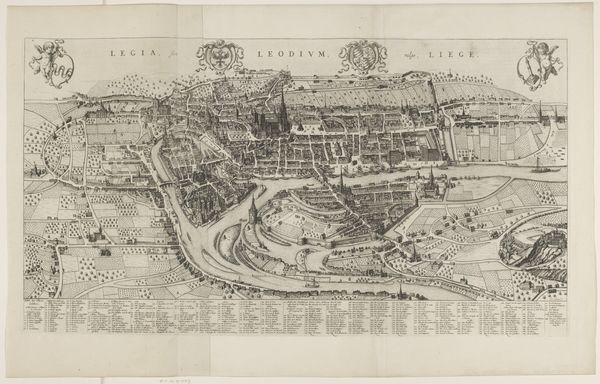
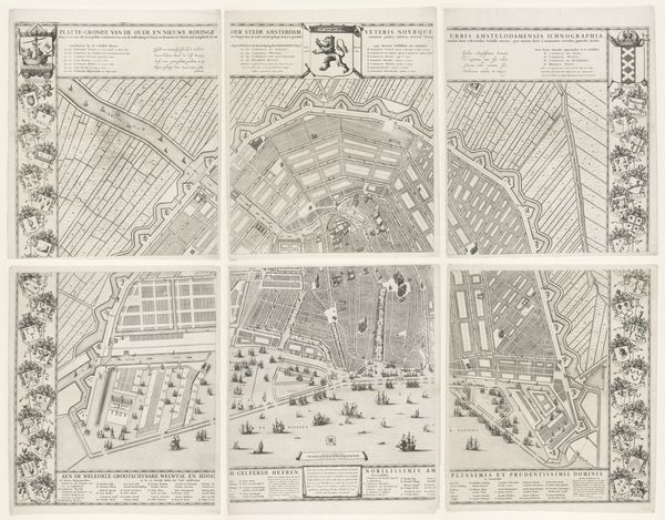
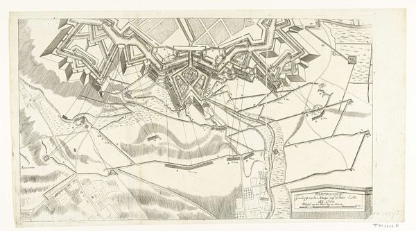
Dimensions: height 507 mm, width 843 mm
Copyright: Rijks Museum: Open Domain
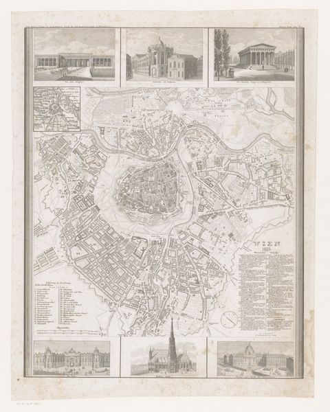
Curator: We're looking at a work called "Plattegrond van Rome," an engraving by Giulio Testone, dating back to around 1670 to 1773. Editor: My initial response is that this evokes a feeling of structured grandeur, and almost scientific detail, while holding a delicate texture created by its aged, monochrome quality. It seems exceptionally detailed, almost dizzying in its precision. Curator: Yes, Testone's engraving beautifully depicts the cityscape of Rome during the late Baroque era. Maps like these are far more than mere directions; they are potent symbols of power, control, and understanding the known world. It serves almost as a declaration of Rome's dominance through visual representation, cementing its cultural and political identity for generations. Editor: From a formal perspective, it is compelling how Testone balances areas of high detail – particularly in the rendering of architectural structures – with the smoother planes that make up areas such as hills. This use of chiaroscuro with line weights and hatching generates volume while emphasizing a contrast between nature and urban development. Curator: Indeed. The very act of creating this meticulous image can be read as claiming Rome, imposing order on its landscape. In the 17th and 18th centuries, having access to and controlling cartography was a status symbol; a privilege. The map’s imagery shaped how people both within and outside the city perceived its reality. It became a shared reference point in collective memory. Editor: I see, the structure and lines give rise to something more—a dialogue, almost, about culture—where technique meets power to build monuments and collective imagination in one artistic, sprawling work. It is through the artist’s meticulous, formal methods that culture lives on. Curator: Absolutely, and I find the layering of history here striking—to consider Rome not simply as geography but as palimpsest of eras, layered meanings. We can see the cultural continuity through these carefully rendered landmarks. Editor: It has been fascinating to consider how close looking can reveal how we see power embodied within art's very infrastructure. Curator: Agreed, and examining its historical implications allows us to reflect upon how the art continues speaking today.
Comments
No comments
Be the first to comment and join the conversation on the ultimate creative platform.
More like this