print, engraving
baroque
dutch-golden-age
landscape
cityscape
engraving
Dimensions: height 457 mm, width 558 mm
Copyright: Rijks Museum: Open Domain
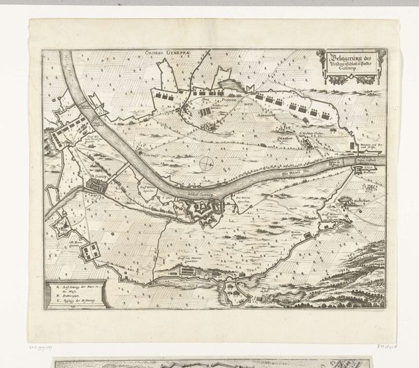
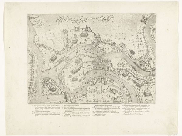
This print, made in 1601 by an anonymous Dutch artist, depicts the siege of Rheinberg. The printmaking process begins with an image carefully incised into a metal plate, usually copper. This one, judging by the fineness of the lines, was likely achieved with a tool called a burin, pushed across the surface. The resulting network of grooves holds ink, which is then transferred to paper under great pressure. Look closely, and you can see the characteristic "plate mark" around the image. The process allows for the creation of multiple identical impressions, making images widely accessible. In the early modern period, printed images played a crucial role in disseminating information, like this detailed depiction of military strategy. The seemingly neutral rendering of the landscape is in fact a political tool, showcasing Dutch military prowess. Consider the labour involved, from the engraver to the press operator – all contributing to the circulation of power through reproducible images. This reminds us that even seemingly straightforward images have a complex story of materials, making, and political intent.
Comments
No comments
Be the first to comment and join the conversation on the ultimate creative platform.