drawing, print, ink, engraving, architecture
#
drawing
#
baroque
# print
#
ink
#
cityscape
#
engraving
#
architecture
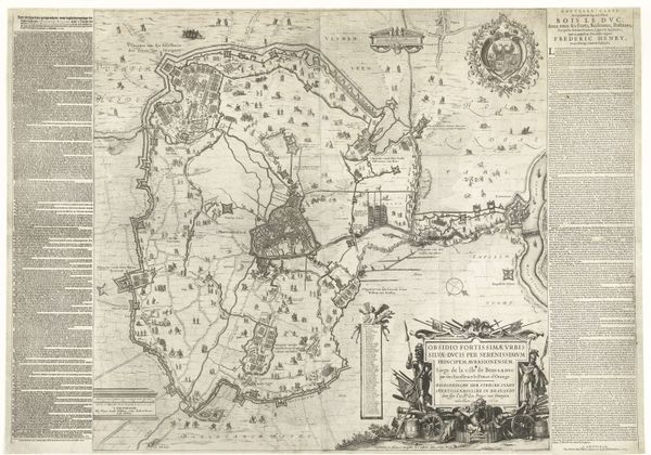
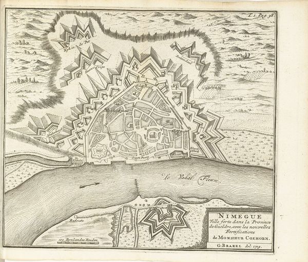
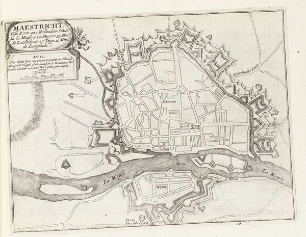
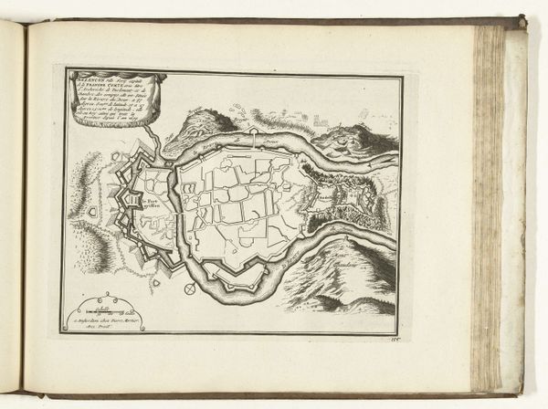
Dimensions: height 227 mm, width 288 mm
Copyright: Rijks Museum: Open Domain
This is an anonymous print from around 1693 to 1696, offering a plan of Besançon. The linear precision defines this composition, where the city's layout is meticulously structured. Notice how the lines not only map out urban space, but also create a visual hierarchy that emphasizes military architecture. The city is captured at a pivotal time, reflecting an era when urban planning was synonymous with strategic defense. The fortifications, depicted with a sharp, angular exactness, reveal an underlying order. The surrounding landscape, including the river Doubs, is integral to the city's defensive posture. What we see here isn’t just geography, but the intersection of space, power, and representation. The cartographer’s decision to prioritize certain visual elements over others conveys a very specific worldview and perhaps speaks to deeper cultural anxieties and ambitions. The engraving serves as a reminder of how deeply intertwined cartography is with broader philosophical questions about perspective, authority, and the control of space.
Comments
No comments
Be the first to comment and join the conversation on the ultimate creative platform.
More like this