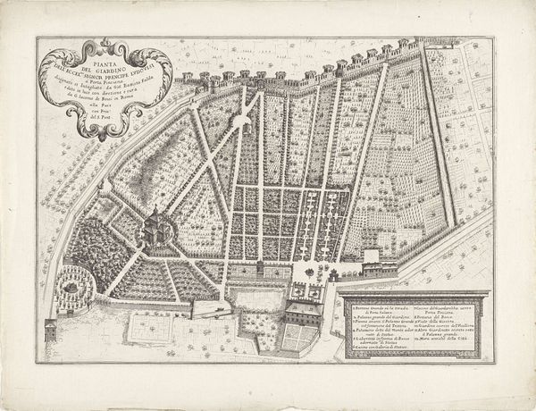
drawing, print, engraving
#
drawing
#
baroque
# print
#
old engraving style
#
geometric
#
cityscape
#
engraving
Dimensions: height 231 mm, width 278 mm
Copyright: Rijks Museum: Open Domain
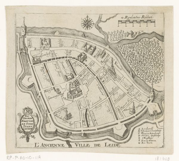
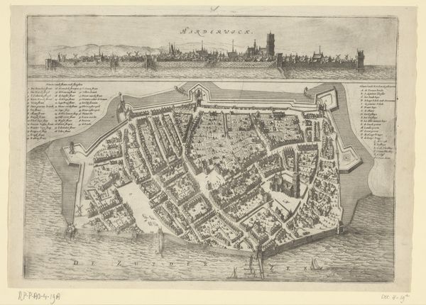
Editor: So this print, "Plattegrond van Oostende," created anonymously around 1700-1710, is an engraving depicting a cityscape. It looks very geometric and precise. What do you see in terms of how it reflects the historical and cultural context through its materiality and process? Curator: What strikes me immediately is the method of production itself. Engraving, as a technique, demands a certain precision and control over the material – in this case, likely a copper plate. Consider the labor involved, the skill needed to render this complex city plan. The very act of engraving, cutting into the metal, is a forceful, deliberate act of creation and record keeping. Doesn't the depiction of the city also emphasize production? Editor: That’s true, it's like a document of the time. How the city itself might have been seen as this engine of production and also a result of the time, not necessarily trying to represent the artistic value as just the reality, as opposed to a landscape for example. Curator: Exactly! Look at the walls surrounding the city, each hatch mark a conscious decision. These aren’t just lines on paper; they represent physical fortifications, societal power, and access to it. The map provides us with not just a view of a city, but a detailed record of labor, production and a particular point in time. What implications might this have? Editor: It really shifts my thinking away from just aesthetic appreciation to understanding it as a produced object embedded within a larger system of labor and control. I was caught up at first thinking how neatly it was engraved, as a print, but it's much more about labor than fine art. Curator: Precisely! Understanding the production helps us understand the society from which it originated and provides context for the city.
Comments
No comments
Be the first to comment and join the conversation on the ultimate creative platform.
More like this