drawing, print, paper, ink
#
drawing
# print
#
landscape
#
paper
#
ink
#
romanticism
#
orientalism
#
genre-painting
#
history-painting
#
academic-art
Dimensions: height 376 mm, width 531 mm
Copyright: Rijks Museum: Open Domain
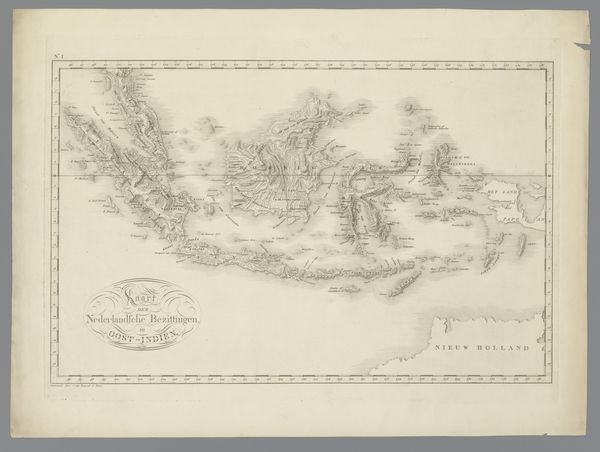
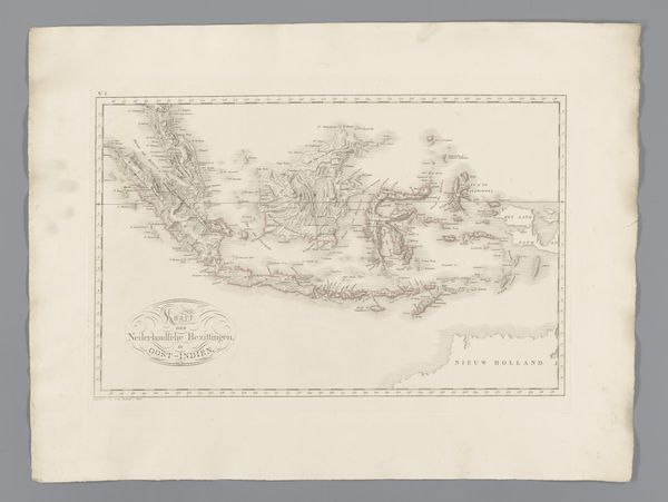
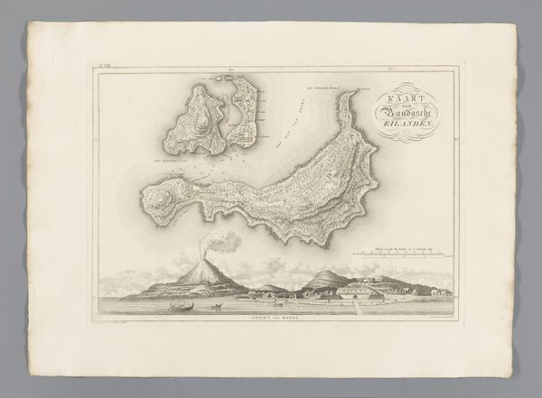
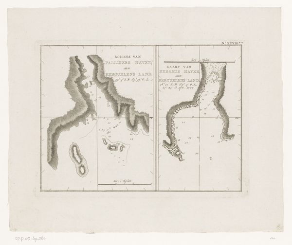
Editor: So this is "Kaart van Ambon en een gezicht op fort Middelburg," a drawing and print made in 1818 by C. van Baarsel en Zoon. It's quite detailed and almost dreamlike. The drawing feels so precise, like it's capturing a distant memory. What stands out to you about this map and its imagery? Curator: Maps, aren’t they fascinating? More than just representations of space, they are coded with power, knowledge, and cultural assumptions. This map of Ambon, rendered with such precision, reveals not just geography, but a worldview. Do you notice the positioning of Fort Middelburg in the vista above the main map? Editor: I do. It’s almost presented as a focal point, a symbol of something. Curator: Precisely. Consider what that "something" might be. The fort, prominently featured, isn't merely an architectural detail; it embodies Dutch colonial power. This image blends objective cartography with subjective visual cues that reify and project power and presence onto the landscape. It invites us to ask: Whose perspective shapes this representation of Ambon? Editor: That's really insightful! It's like the map isn’t just showing the island, but also telling a story about its control. It makes you think about what's included, and what's deliberately left out. Curator: Exactly. Maps participate in world-making. How does seeing it as more than just a geographical document shift your perspective? Editor: I now view it as a historical document and an artistic expression embedded with power dynamics. Curator: Indeed, images preserve a potent blend of history, culture, and psychology, offering continuous reinterpretations across time.
Comments
No comments
Be the first to comment and join the conversation on the ultimate creative platform.
More like this