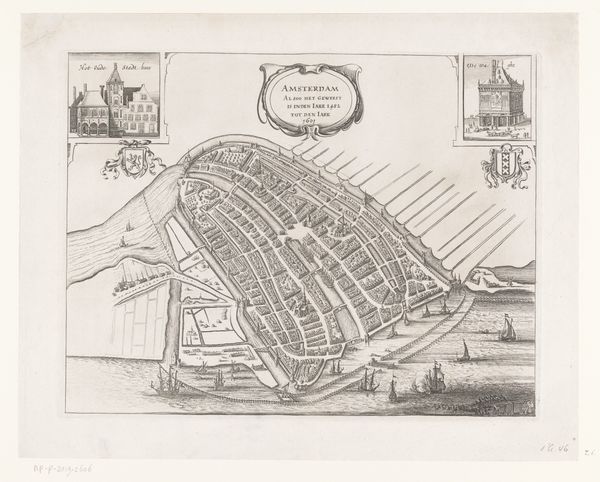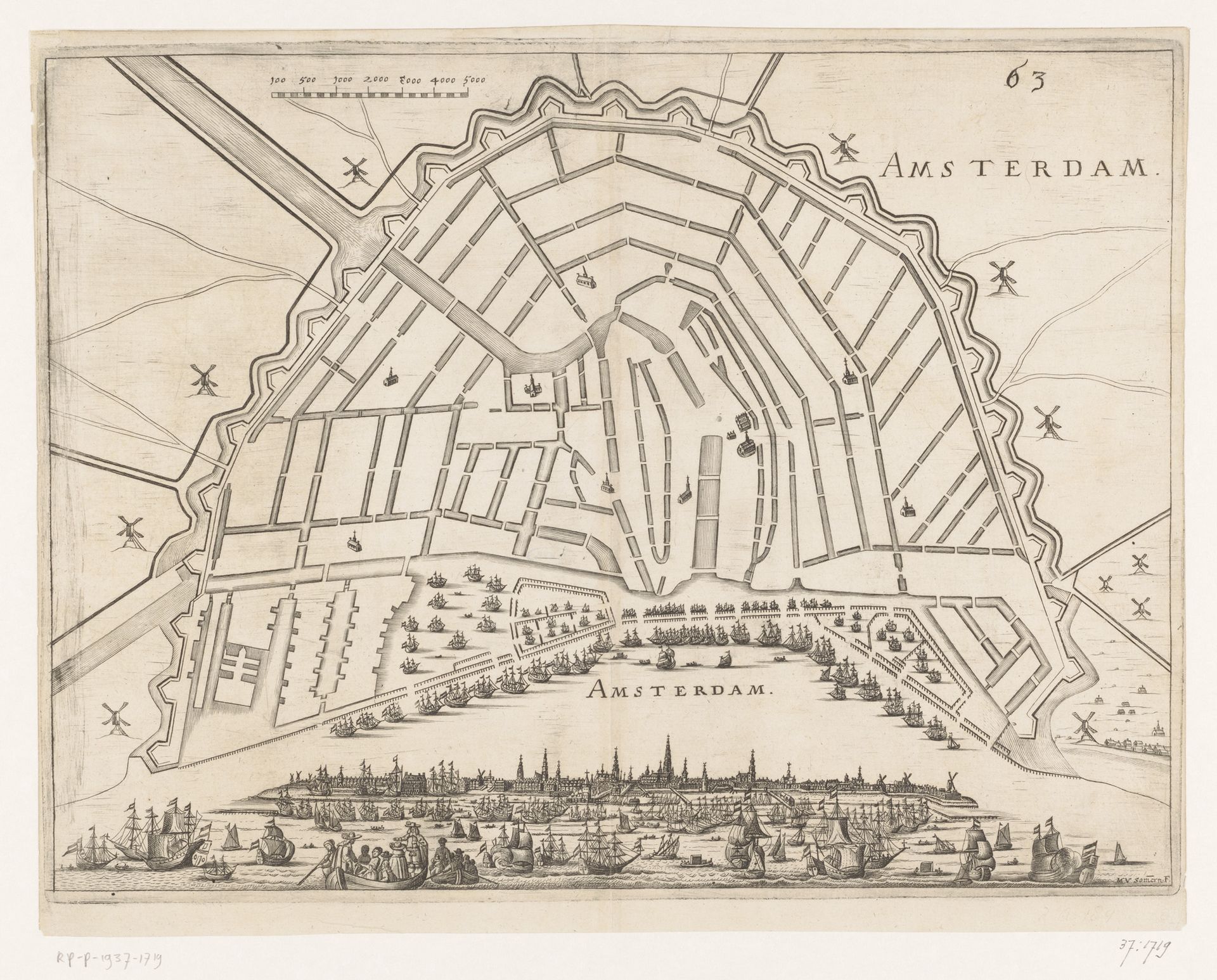
1672 - 1673
Vestingplattegrond van Amsterdam met een gezicht op de stad vanaf het IJ
Listen to curator's interpretation
Curatorial notes
Matthias van Sommer produced this print showing a plan of Amsterdam with a view of the city from the IJ. Maps like this served multiple purposes in their time. On one hand, they were functional documents for navigation and urban planning. But they also functioned as symbols of civic pride and, dare I say, propaganda, particularly in a booming mercantile center like Amsterdam. Look at the precise rendering of the city’s fortifications and the bustling harbor filled with ships. These details project an image of power and prosperity, reflecting the ambitions of the Dutch Republic during its Golden Age. The print invites viewers to admire Amsterdam’s strategic importance and economic might. It’s worth examining the archives of the city itself and consulting contemporary travel accounts to fully grasp the intentions that underpinned the making of this image. By considering the social and institutional contexts, we can better understand how the art was both a reflection of and a contributor to the construction of civic identity.