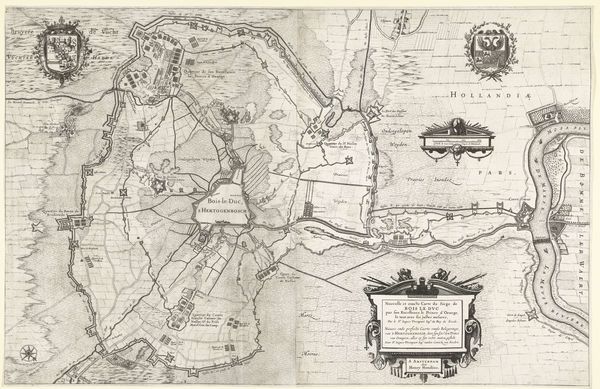
print, ink, engraving
dutch-golden-age
pen illustration
landscape
ink
geometric
cityscape
history-painting
engraving
Dimensions: height 296 mm, width 408 mm
Copyright: Rijks Museum: Open Domain
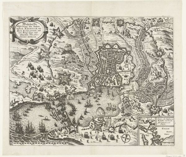
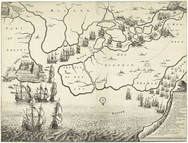
Editor: This print, titled "Kaart van het beleg van La Rochelle, 1627-1628," created in 1628 by Claes Jansz. Visscher, illustrates the siege of a city. The precise lines and ordered geometric shapes give it a sense of cold detachment, despite depicting what I imagine was a chaotic and brutal event. How do you interpret this work, seeing past its purely representational aspects? Curator: It is fascinating how Visscher uses geometric forms to convey this historical moment, wouldn’t you agree? Observe how the composition meticulously maps the siege lines, the city fortifications, and the arrangement of ships in the harbor. Consider the line itself: its weight, its density, its unwavering commitment to delineation. Note the strategic deployment of hatch marks that define the landscape beyond. These formal decisions do more than represent; they articulate a specific worldview, privileging order and control amidst conflict. What meaning can we extract from this artistic choice? Editor: I see what you mean. The emphasis on geometry and detailed rendering flattens the scene, almost abstracting the violence it represents. The stark contrast between land and sea, defined by clear, unwavering lines, makes me wonder about the power dynamics represented through spatial control. The shapes are beautiful and precise, yet they are outlining devastation. Is it right to admire this formal perfection? Curator: Indeed, that very tension between aesthetic refinement and violent subject matter constitutes much of the work’s significance. Visscher, through his precise linework and ordered composition, presents a seemingly detached, almost analytical view of siege warfare, asking us to contemplate the formal structures underlying conflict itself. And that begs a fundamental question: Is it truly detached, or is there a silent justification inherent in the choice of representation? Editor: I never thought about how the artist's choice of style could make an argument itself. Curator: The arrangement certainly provokes new ideas for me.
Comments
No comments
Be the first to comment and join the conversation on the ultimate creative platform.