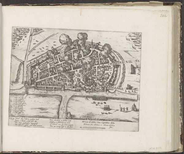
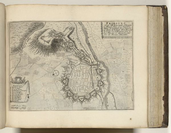
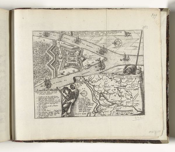
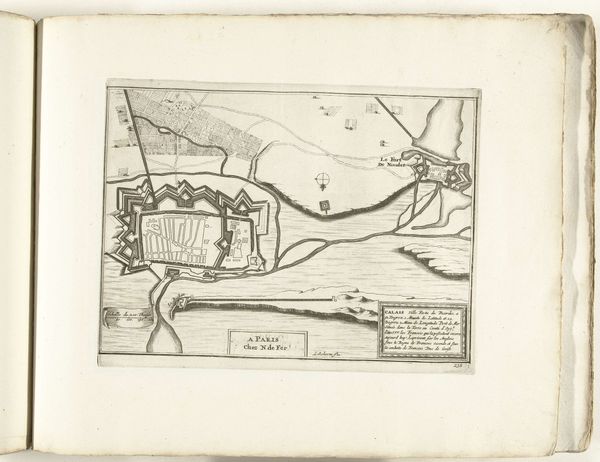
Kaart van het gebied rond Speyer met ontwerp van de vesting Philippsburg, 1618 1618 - 1620
franshogenberg
Rijksmuseum
drawing, paper, ink, engraving
drawing
baroque
landscape
paper
ink
cityscape
history-painting
engraving
Dimensions: height 233 mm, width 303 mm
Copyright: Rijks Museum: Open Domain
Curator: This intricate engraving presents “Kaart van het gebied rond Speyer met ontwerp van de vesting Philippsburg, 1618,” or "Map of the Speyer Area with Design of the Fortress Philippsburg, 1618," created by Frans Hogenberg, currently held in the Rijksmuseum. Editor: The detail is stunning. It almost feels like looking at a blueprint—sterile, utilitarian. There’s something stark about the line work, all practical intent, devoid of artistic flourish, if that makes sense. Curator: Absolutely. It functions more as a record, a tool for visualizing landscape and strategic placements than as art intended purely for aesthetic pleasure. The use of ink on paper, that laborious engraving process, was about reproducible accuracy, enabling widespread dissemination of critical information to those involved in the unfolding political landscape. Editor: Thinking about the period – the escalation of the Thirty Years’ War – shifts my perception. It highlights the power structures and political anxieties shaping artistic output, doesn't it? Who commissioned this map, and how might its reception have differed depending on the viewer’s position within the social hierarchy? It definitely puts a new meaning to city planning. Curator: Precisely. Consider how this particular artifact—an engraving—differs from the traditionally valued painted landscape. While landscape painting might elevate the beauty and sublimity of nature, Hogenberg's engraving presents the land as a resource to be controlled, mapped, and defended. The creation and dissemination of the image served definite geopolitical strategies and ambitions. It challenges how we assign cultural value to different forms of artistic labor and what social and political purposes those choices reveal. Editor: Looking at the lines themselves—how thin and deliberate they are, you almost feel the weight of the burin. The material speaks of precision, and that in turn is linked with military, social control. We can almost trace the way that art has helped establish and legitimize hierarchies in a practical, very material sense. It's amazing what that laborious attention to detail does to give the object social meaning. Curator: Agreed. We begin with a relatively obscure artifact and suddenly its physical presence within that specific historical frame allows it to communicate vital insights on materiality and early modern power structures. Editor: It transforms the way I read traditional historical narratives; it grounds abstract forces, offering a textured look into artistic creation within early modern geopolitical realities.
Comments
No comments
Be the first to comment and join the conversation on the ultimate creative platform.