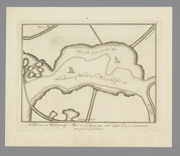
Kaart van het atol Kiritimati in de Grote Oceaan, door James Cook in 1777 ontdekt 1802
0:00
0:00
drawing, print, ink, engraving
#
drawing
#
blue ink drawing
# print
#
old engraving style
#
landscape
#
ink
#
pen-ink sketch
#
orientalism
#
engraving
Dimensions: height 185 mm, width 236 mm
Copyright: Rijks Museum: Open Domain
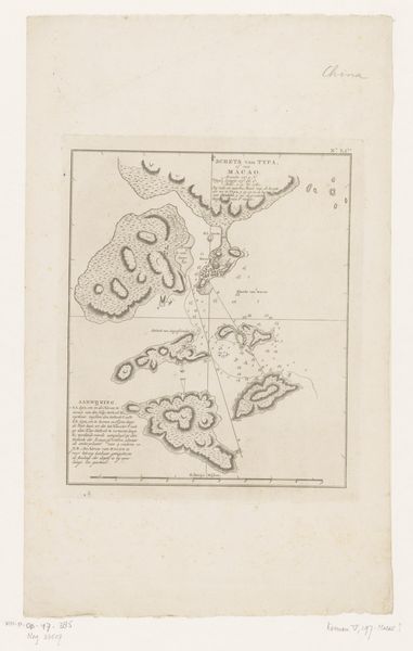
Curator: Here we have a print from 1802 titled "Kaart van het atol Kiritimati in de Grote Oceaan, door James Cook in 1777 ontdekt"—that is, "Map of the Kiritimati Atoll in the Pacific Ocean, Discovered by James Cook in 1777." It's an engraving that showcases the atoll's unique form. Editor: It's striking how the delicate lines and cool blues give this scientific document a slightly eerie quality. Like an isolated memory of colonialism trapped on paper, even. What does it suggest to you? Curator: To me, this map reflects a very particular mindset, and that’s the scientific impulse meeting the visual language of the time. Cartography was almost like a language itself, filled with symbolic ways to portray landscapes. Think about how islands, since antiquity, have stood for both isolation and utopian potential. Editor: Right, and who gets to decide on the symbolic meaning of a place? Cook "discovered" Kiritimati, as the title states, but the island had its own rich history long before Western cartographers mapped it and named it "Christmas Island." What narrative were the British constructing about Pacific territories and people through acts of surveying and mapping? Curator: Maps like these are visual tools for laying claim. In older maps, you find sea monsters representing the unknown. Here, though, the "emptiness" becomes an invitation for control and for rationalization. The map is a signifier. Editor: A signifier laden with ideology. Even the seemingly neutral act of charting territory becomes implicated in asserting authority. As an object of scientific and aesthetic appreciation, the map also functions as a reminder that history isn't just about the past; it continues to shape contemporary discourse around territory and power. Curator: I see it as a relic imbued with many historical attitudes. We’re reminded how an object can resonate with a specific historical viewpoint but open conversations about identity, land, and ownership today. Editor: Absolutely, and interrogating these historical objects can offer insights on issues surrounding power and identity which affect present circumstances.
Comments
No comments
Be the first to comment and join the conversation on the ultimate creative platform.
More like this