print, paper, engraving
# print
#
landscape
#
paper
#
11_renaissance
#
cityscape
#
northern-renaissance
#
engraving
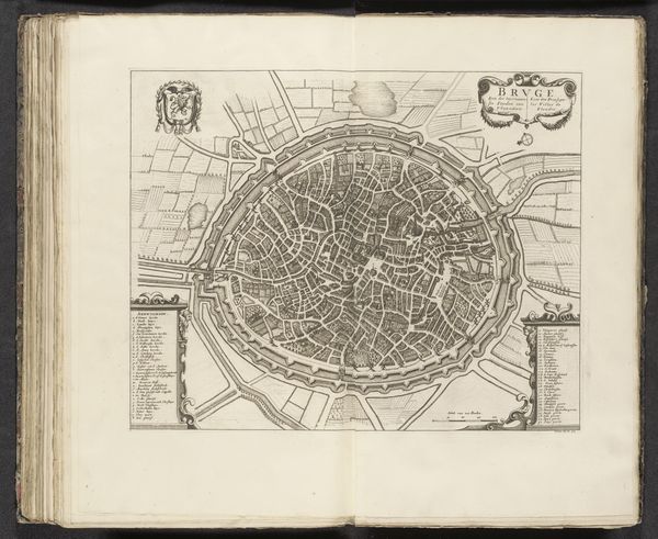
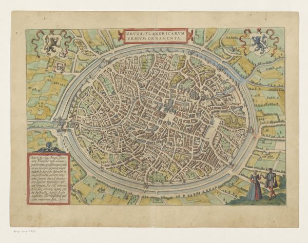
Dimensions: height 525 mm, width 740 mm
Copyright: Rijks Museum: Open Domain
Editor: Here we have an engraving from 1612 entitled "Plattegrond van Brugge," or "Map of Bruges," made anonymously on paper. The city is depicted almost as a series of concentric circles. It strikes me how orderly it appears, almost like a geometrical design rather than a living, breathing place. What do you make of this print? Curator: Indeed. Notice the stark contrast achieved through the precise engraving technique. The density of lines defines the city's form, creating varied textures representing built structures and open spaces. Note the circular composition. This creates a sense of self-containment, a visual closure reinforcing Bruges as a discrete, defined entity. Editor: Are you suggesting the artist deliberately chose this structure to say something specific about Bruges? Curator: The circular format may echo contemporary cosmologies, presenting the city as a microcosm of a larger ordered universe. Furthermore, consider the orthogonal lines representing the urban layout. This conveys a sense of rational planning and control over space, quite distinct from the organic messiness we associate with a pre-modern urban centre. Ask yourself, what meaning may be ascribed to this tension between order and practicality? Editor: That's a great question to consider. Looking closer, you're right—the density of lines gives depth to the textures. The layout is a balance, depicting real geography but presented with precise formal features. I'll be sure to analyze other artworks with that structural consideration in mind! Curator: Precisely! By examining these visual choices—line, composition, and form—we access a richer understanding that goes beyond mere representation.
Comments
No comments
Be the first to comment and join the conversation on the ultimate creative platform.
More like this