drawing, print, ink, pen, engraving
#
drawing
#
aged paper
#
toned paper
# print
#
old engraving style
#
sketch book
#
personal sketchbook
#
ink
#
pen-ink sketch
#
pen and pencil
#
pen work
#
sketchbook drawing
#
pen
#
cityscape
#
sketchbook art
#
engraving
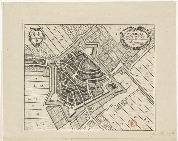
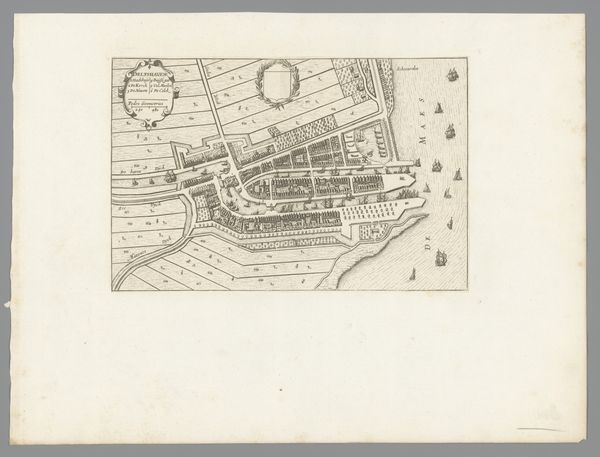
Dimensions: height 208 mm, width 262 mm
Copyright: Rijks Museum: Open Domain
This is an anonymous map of Woerden, created in 1726. In the early 18th century, the Dutch Republic was a major player in global trade and politics, but internally, there were tensions between different social classes and political factions. This map gives us a glimpse into the social and political landscape of the time. Woerden, a small town in the province of Utrecht, was a strategic location, and its fortifications reflect the ongoing concerns about defense and security. The detailed depiction of streets, buildings, and waterways reveals a society that valued order and control. We see a clear hierarchy in the layout of the town, with the wealthier residents living closer to the center and the poorer ones on the outskirts. What stories are not being told here? Who was excluded from this vision of Woerden? As you look, consider how this map both reflects and shapes our understanding of the past.
Comments
No comments
Be the first to comment and join the conversation on the ultimate creative platform.
More like this