drawing, print, paper, ink, engraving
#
drawing
#
aged paper
#
toned paper
#
dutch-golden-age
# print
#
pen sketch
#
old engraving style
#
sketch book
#
paper
#
personal sketchbook
#
ink
#
pen-ink sketch
#
pen work
#
sketchbook drawing
#
cityscape
#
sketchbook art
#
engraving
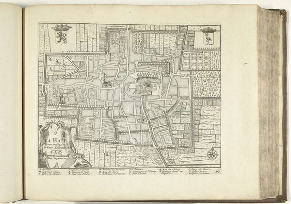
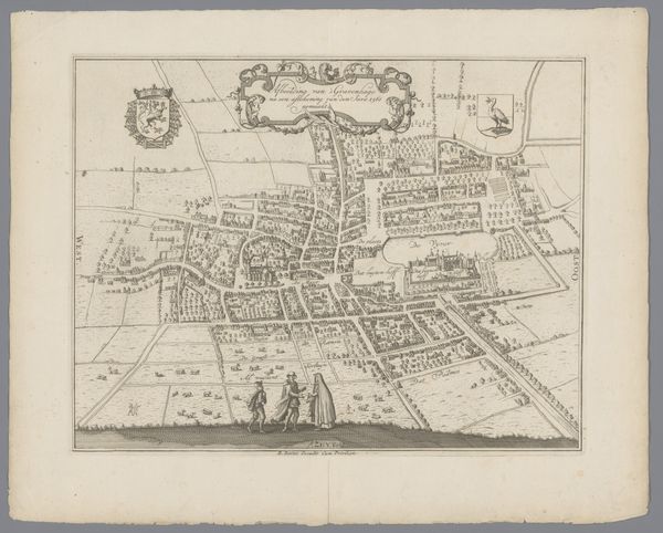
Dimensions: height 236 mm, width 288 mm
Copyright: Rijks Museum: Open Domain
This is an anonymous map of The Hague, created around 1702. At first glance, the rigid layout speaks to the values of order and control. But look closer, and you'll see a language of symbols that transcends mere geography. Above, heraldic crests feature a rampant lion and a peculiar bird. These symbols, like characters in a myth, have journeyed through time, adorning flags, shields, and emblems of power across Europe. Their appearance here is not accidental. Consider the lion, its roar echoing through centuries, a symbol of courage, dominion, and the primal forces that drive human ambition. And the bird, perhaps an eagle, a symbol of foresight and heavenly connection. These symbols are like dream images, encoded with layers of meaning, forever resurfacing in our collective consciousness, speaking to the non-linear, cyclical progression of symbolic language. It's a visual echo, as if the city itself were a stage upon which timeless dramas of power and identity are enacted, forever evolving, forever resonating.
Comments
No comments
Be the first to comment and join the conversation on the ultimate creative platform.
More like this