drawing, print, paper, ink
#
drawing
#
baroque
# print
#
paper
#
ink
#
geometric
#
cityscape
Dimensions: height 317 mm, width 403 mm
Copyright: Rijks Museum: Open Domain
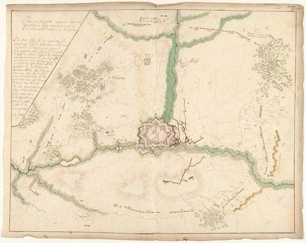
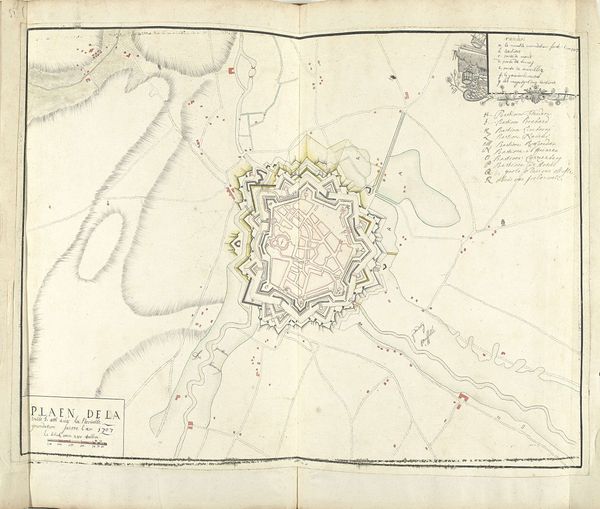
This is a plan of Hasselt in the Netherlands, made with pen and watercolor by Samuel Du Ry de Champdoré around 1701-1715. The drawing depicts the town as seen from above, surrounded by defensive walls and waterways. This map embodies the social and political conditions of the early 18th century. The detailed fortifications highlight the ever-present threat of military conflict and the need for urban centers to defend themselves. The neat, ordered layout of the town reflects a desire for control and stability. We can explore the social structures of the time through such maps: the division of space, the location of key buildings, and the relationship between the town and its surroundings. The map offers a glimpse into the institutional history of Hasselt, revealing its administrative structure. As historians, we can use sources like municipal records, military archives, and personal accounts to interpret this map in its full social and institutional context. The art of cartography is contingent on these factors.
Comments
No comments
Be the first to comment and join the conversation on the ultimate creative platform.
More like this