print, engraving
#
dutch-golden-age
# print
#
landscape
#
engraving
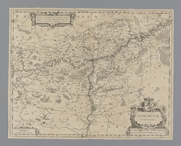
Dimensions: height 394 mm, width 498 mm
Copyright: Rijks Museum: Open Domain
Curator: At first glance, this print feels like a rather dry document. The color is faded and details are muted, it almost suppresses the lived reality of its time. Editor: On the contrary, the act of detailed record keeping, especially the production of maps, says a lot about power, ownership and our relationship to our surroundings! This is 'Kaart van het graafschap Namen', or Map of the County of Namur. Made in 1638, it’s currently held at the Rijksmuseum. The meticulous lines of the engraving, produced in print, really capture a world being measured and organized. Curator: Yes, but to what end? The choice of materials, an engraving in print, suggests function over beauty. It prioritizes efficient production. Did they see it as art, or strictly utilitarian? What about the labor required to create it? I would guess skilled engravers and draftsmen were vital in making this thing. Editor: Absolutely, we can also view maps as reflections of their era's socio-political realities. The rise of cartography coincided with the age of exploration and burgeoning nation-states. The map wasn't merely a representation; it actively shaped territories by claiming and defining them! Also notice the decorative elements; coats of arms were not purely aesthetic features, but assertions of political and economic control over territories! Curator: So you’re saying this image normalizes control? I suppose one could compare this piece with woven textiles of the era – similarly patterned, perhaps similarly valued in trade or dowries, depending on the owner, each reflecting complex systems of value. Were maps viewed as instruments to bolster authority and ensure resource acquisition? The work is anonymous, though I'd be curious who paid for its production, where were these maps distributed, and how were they used. Editor: Yes, it is fascinating. Considering that it dates to 1638, a time of significant European political and economic development, cartography must have represented some awareness of the Dutch Golden Age within global frameworks. It is more than just lines on paper, isn't it? Curator: Agreed, viewing it through the lens of production helps illuminate the power structures at play. It speaks to both control of materials and spaces in our world. Editor: It makes me want to dive deeper into the county's archives and understand its impact!
Comments
No comments
Be the first to comment and join the conversation on the ultimate creative platform.
More like this