drawing, print, ink, engraving
#
drawing
#
aged paper
#
toned paper
# print
#
old engraving style
#
landscape
#
personal sketchbook
#
ink
#
pen-ink sketch
#
pen and pencil
#
pen work
#
sketchbook drawing
#
storyboard and sketchbook work
#
northern-renaissance
#
sketchbook art
#
engraving
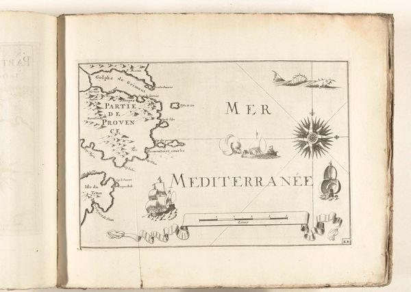
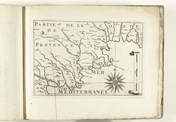
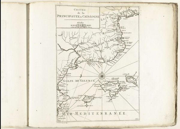
Dimensions: height 233 mm, width 335 mm
Copyright: Rijks Museum: Open Domain
Curator: Here we have an intriguing cartographic piece from 1726, titled "Kaart van de Franse zuidkust bij Saint-Tropez," created by an anonymous artist. The work is comprised of ink and engraving on paper and currently resides in the Rijksmuseum. Editor: The stark contrasts in this aged map grab my eye first. The paper has toned beautifully, providing an excellent foil for the sharp black ink. Curator: Indeed, the graphic quality is undeniable. Observe the careful articulation of the lines—the varying thicknesses create a subtle sense of depth and volume, especially in the depiction of the terrain. The composition leads the eye along the coastline, emphasizing a visual pathway. Editor: I'm more drawn to the labor that created this. The meticulous engraving process! Think about the engraver's dedication, etching such fine details in reverse on a copper plate. It's an impressive display of skilled craftsmanship. We must also consider the social context in which it was conceived and received. Cartography was crucial not only for navigational purposes but for geopolitical reasons. Curator: Valid point. The strategic importance of such a detailed depiction shouldn't be discounted. Yet, what of the artistic choices? Look at the decorative elements—the wind rose, the stylized ships, even the cartouche framing the scale bar. These embellishments speak to an aesthetic intent beyond mere functionality. They remind me of early book illustration and ornament. Editor: Those elements show the cultural and economic conditions and needs in this era. The act of mapping had both strategic and cultural implications. Understanding that reveals how intertwined art and social life could be. Curator: A persuasive interpretation. It highlights how even seemingly technical drawings such as maps bear complex artistic, societal, and practical dimensions. Editor: Yes, analyzing both the "how" and the "why" expands the depth of experience. Curator: I shall remember it going forward. Thank you for bringing in new layers of thought regarding its original functionality and the work's production. Editor: It’s been quite enlightening!
Comments
No comments
Be the first to comment and join the conversation on the ultimate creative platform.
More like this