drawing, print, engraving
drawing
dutch-golden-age
cityscape
engraving
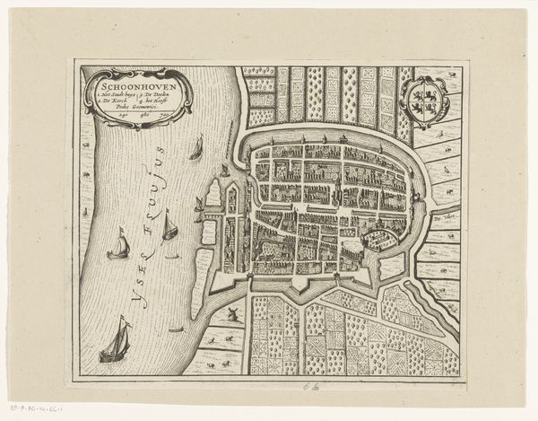
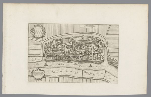
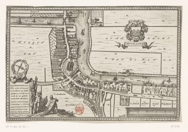
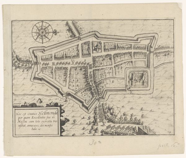
Dimensions: height 154 mm, width 233 mm
Copyright: Rijks Museum: Open Domain
Editor: This is the "Plattegrond van Leerdam," a 1632 engraving currently housed in the Rijksmuseum, created by an anonymous artist. It's a cityscape—a bird's eye view, really—rendered in incredible detail. It almost feels like I'm looking at a meticulously crafted dollhouse. What do you make of it? Curator: Ah, yes! What I see is a world carefully constructed. A living entity, if you will, veins of waterways pulsing with life, contained, quite purposefully, within defined borders. Almost as if the city *is* the jewel. Notice the details. Tiny houses huddled together, like secrets shared. Editor: It's funny you say "jewel" because the whole map almost feels like a gem, cut and polished! I can't even imagine drawing every building like that. What's the deal with those neat square shapes surrounding the city? Curator: Land! Dutch Golden Age land management! That very structured countryside hints at a society intent on organization and control. It’s like they’re imposing their will upon nature itself. I wonder... can you almost *hear* the city from here? Editor: Now that you mention it, yes! A quiet industriousness. But who decided to commission something like this, and why engrave it as a print? Was it pure city pride, or were there other incentives? Curator: Perhaps both, in equal measure. It could have served as a symbol of civic power, a promotional piece, a planning document even. These weren't just representations; they were statements of intent! Maybe, just maybe, somebody wanted bragging rights to having the most organized set of dykes this side of Amsterdam! What I find exciting is thinking about *who* saw it, dreamed about it, feared it! Editor: That's amazing. Now when I look at this piece, it's not just a pretty cityscape anymore! I understand the level of communication here... Thank you! Curator: And thank *you*. That 'dollhouse' of yours is now full of potential dramas. Always imagine the *stories* the objects are screaming out!
Comments
No comments
Be the first to comment and join the conversation on the ultimate creative platform.
More like this