About this artwork
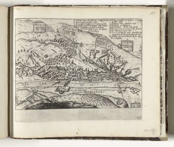
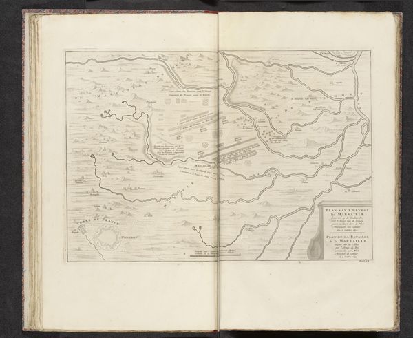
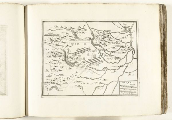
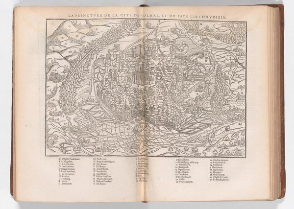
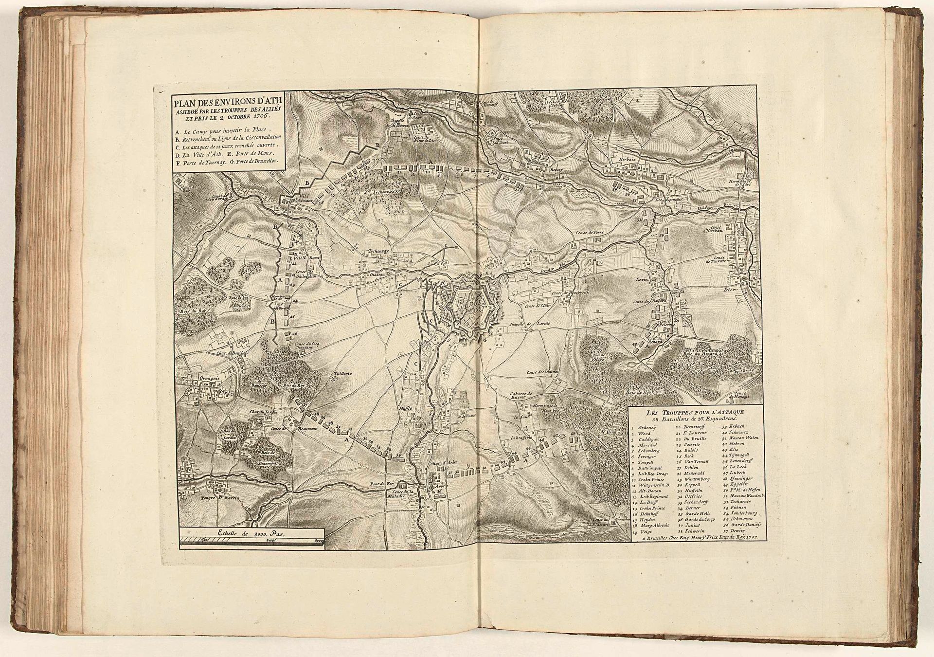
Curator: Looking at this print, made with ink and engraving techniques, I’m immediately drawn to its impressive intricacy. It presents "Beleg van Ath, 1706", or "Siege of Ath, 1706" in English. Editor: Wow, it's all lines! Like a delicate, detailed cobweb spun across the page. Gives a bird's-eye perspective, like I'm floating high above the land, observing the drama unfolding below. Makes you feel like an all-seeing, all-knowing... well, not-intervening god. Curator: Precisely. The artist, Jacobus Harrewijn, created this piece in 1707, immortalizing the event that happened a year prior. It’s quite characteristic of the Baroque style, if you examine the balance, depth and ornate details. Notice the map's structural rigor. Editor: Baroque maps—that’s a thing! It feels kind of paradoxical. On one hand, the strict geometric shapes contrast with the swirling, energetic battles laid out in the picture. What an ingenious artistic expression of war! Like capturing chaos, meticulously, right? Curator: The semiotic density of the cartographic language is profound. Every line signifies a road, a boundary, a tactical position, all meticulously placed within the pictorial field. A complex system of visual data presented through artful design. Editor: And isn’t there something so profoundly tragic about this kind of art? War immortalized with elegant strokes, as if violence is some spectacle for our drawing-room amusement! Even the list of locations—each, most probably, a place where people struggled, and bled, and probably died. How curious and weird! Curator: I concur that, the objective rendering clashes somewhat dramatically with the harsh realities the plan seeks to represent. It reminds us how conflict is mediated. We have here an artistic distillation of conflict, analyzed and recorded, far removed from lived experience. Editor: This experience gave me the chance to reflect a lot on art's strange power of detachment, its ability to aestheticize even the most brutal events! I have a newfound appreciation for how maps can conceal or reveal human suffering! Curator: For me, seeing how Harrewijn masterfully balances visual form with informational content is definitely interesting. The artwork underscores that an artistic form itself offers its own commentary on events. A must-see here at the Rijksmuseum!
Artwork details
- Medium
- drawing, print, ink, engraving
- Dimensions
- height 366 mm, width 470 mm
- Location
- Rijksmuseum
- Copyright
- Rijks Museum: Open Domain
Tags
drawing
baroque
landscape
ink
engraving
Comments
Be the first to share your thoughts about this work.
About this artwork
Curator: Looking at this print, made with ink and engraving techniques, I’m immediately drawn to its impressive intricacy. It presents "Beleg van Ath, 1706", or "Siege of Ath, 1706" in English. Editor: Wow, it's all lines! Like a delicate, detailed cobweb spun across the page. Gives a bird's-eye perspective, like I'm floating high above the land, observing the drama unfolding below. Makes you feel like an all-seeing, all-knowing... well, not-intervening god. Curator: Precisely. The artist, Jacobus Harrewijn, created this piece in 1707, immortalizing the event that happened a year prior. It’s quite characteristic of the Baroque style, if you examine the balance, depth and ornate details. Notice the map's structural rigor. Editor: Baroque maps—that’s a thing! It feels kind of paradoxical. On one hand, the strict geometric shapes contrast with the swirling, energetic battles laid out in the picture. What an ingenious artistic expression of war! Like capturing chaos, meticulously, right? Curator: The semiotic density of the cartographic language is profound. Every line signifies a road, a boundary, a tactical position, all meticulously placed within the pictorial field. A complex system of visual data presented through artful design. Editor: And isn’t there something so profoundly tragic about this kind of art? War immortalized with elegant strokes, as if violence is some spectacle for our drawing-room amusement! Even the list of locations—each, most probably, a place where people struggled, and bled, and probably died. How curious and weird! Curator: I concur that, the objective rendering clashes somewhat dramatically with the harsh realities the plan seeks to represent. It reminds us how conflict is mediated. We have here an artistic distillation of conflict, analyzed and recorded, far removed from lived experience. Editor: This experience gave me the chance to reflect a lot on art's strange power of detachment, its ability to aestheticize even the most brutal events! I have a newfound appreciation for how maps can conceal or reveal human suffering! Curator: For me, seeing how Harrewijn masterfully balances visual form with informational content is definitely interesting. The artwork underscores that an artistic form itself offers its own commentary on events. A must-see here at the Rijksmuseum!
Comments
Be the first to share your thoughts about this work.