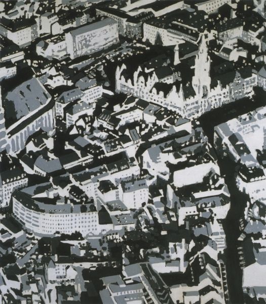
print, photography
# print
#
photography
#
cityscape
Dimensions: height 12 cm, width 16 cm
Copyright: Rijks Museum: Open Domain
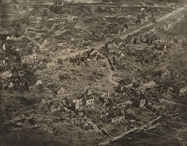
Curator: My first thought? Order. A kind of imposed organization. You know, a little unsettling but also, admittedly, fascinating. Editor: Fascinating is a great word. We're looking at an aerial photograph here. The title is "Het Leidseplein in Amsterdam vanuit de lucht," taken by the Rijksluchtvaartdienst, likely sometime between 1930 and 1935. It’s a black and white print of a cityscape, offering this rather unique, birds-eye view of a major Amsterdam square. Curator: Exactly. Birds have such perspective. Do you think they ever reflect on all the lives they are seeing laid out below? Editor: It forces a macro perspective, doesn't it? Makes you think about urban planning, about control, about access… you notice, of course, who *isn't* in the frame. Whose perspectives aren’t represented from above. Curator: I guess, but it makes me reflect on our desire for overview, to map things, to define systems even from such a height. Maybe that's more about my human condition. I'm definitely in that frame; my own assumptions laid bare! It looks so fragile and precious at that height too, don’t you think? Editor: Definitely fragile. And I think that sense of preciousness is really amplified by that pre-war date. The clean lines of urban planning almost feel like a futile attempt at order in the face of the chaos that’s just around the corner. Curator: Wow. So there's the beauty and dread. Editor: I guess aerial views can highlight a whole manner of social complexities as it flattens us out so beautifully. Curator: Right! But a drone feels a bit different. It doesn’t require all that pre-war planning. Does it strip it away? Interesting, but this offers much reflection; the human and the political laid bare, and still beautiful. Thank you for opening my mind. Editor: Likewise, this piece makes it possible to see both intimate lives, as well as social narratives unfold in new ways, almost one hundred years on! A unique lens.
Comments
No comments
Be the first to comment and join the conversation on the ultimate creative platform.
More like this