graphic-art, print, engraving
#
graphic-art
#
baroque
# print
#
geometric
#
cityscape
#
engraving
Dimensions: height 420 mm, width 514 mm
Copyright: Rijks Museum: Open Domain
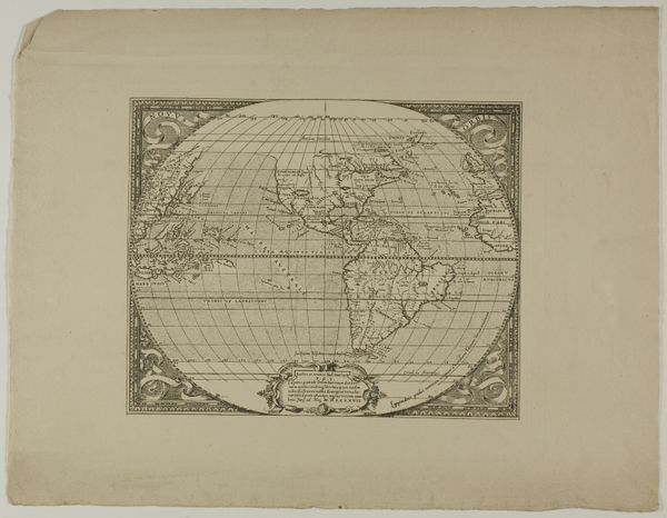
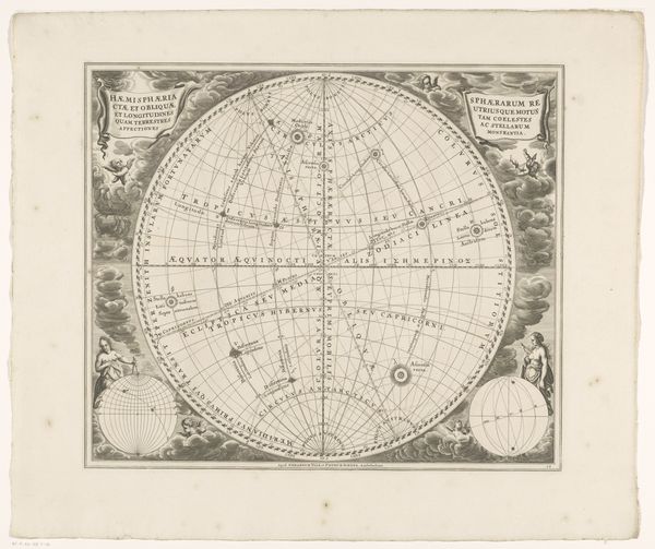
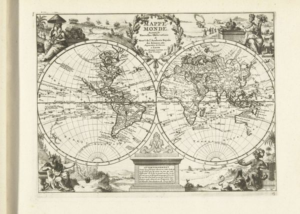
Editor: This engraving, titled "Kaart van het oostelijk halfrond met verschillende klimaatzones," was created by Johannes van Loon sometime between 1660 and 1708. The detail is incredible, almost overwhelming. What strikes me most is the mix of scientific ambition and decorative style. What do you see when you look at this map? Curator: The map teems with a potent blend of nascent scientific observation and deeply ingrained cultural narratives. Notice how the division of the world into climatic zones is presented within an elaborate, almost baroque frame. The frame itself acts as a symbol, marking the boundary between the known and the unknown, civilization and the perceived "other." Editor: So the ornamentation isn't just decoration, it's actually part of the message? Curator: Precisely. Consider the use of Latin, situating this knowledge within a classical, European tradition. Look, too, at the compass roses tucked into the corners. These are not merely navigational aids, they’re also symbols of orientation, control, and the imposition of order on a world that was still, in many ways, being conceptualized and, some would argue, conquered by European powers. What do you make of the relative placement and size of continents? Editor: I see Africa and Asia much larger in comparison to Europe. Perhaps reflective of their perceived importance at the time, or simply how well they were known to the mapmaker? Curator: That's a keen observation. These maps, in a very real sense, projected the anxieties and aspirations of their time. The symbolic weight carried by geographical representations is substantial. It offers insight not just into where places are, but what those places meant to the people charting them. Editor: That's fascinating. I never considered how much cultural baggage a map could carry. Curator: Maps are powerful visual tools. They define, they claim, and they memorialize specific ways of seeing the world.
Comments
No comments
Be the first to comment and join the conversation on the ultimate creative platform.
More like this