Curatorial notes
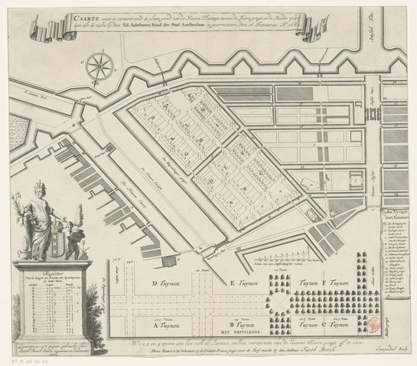
Curator: So, this is Robert Jacob Gordon's "Map of Cape Town," created around 1777-1778 using watercolor. It’s fascinating, isn't it? Editor: It is! What strikes me immediately is the incredible detail for a map from so long ago, it almost feels more like a painting. There is something appealing and a little strange in how it mixes geographical and figurative representation. How do you interpret this work, placing it within its cultural context? Curator: Ah, but it *is* a painting, of sorts! Look how artfully he blends cartography with artistry. For Gordon, drawing was also a form of control, the way the European empires exerted control over distant lands and peoples through their geographical surveys. This isn’t merely a record; it's a carefully constructed narrative. Consider how the legend is rendered like an illuminated manuscript. What does that say to you? Editor: So, it's both about knowledge and power. By documenting Cape Town, he’s claiming it in a way. But why the artistic flourish? Was it typical to combine art and cartography? Curator: Precisely! Remember, maps weren’t just functional back then, especially for colonial powers. This blend reinforced dominance—knowledge beautifully rendered affirmed authority. Also, Gordon was part of the Dutch Golden Age tradition, which embraced landscape painting. Mapping could become an exercise in this landscape tradition. Do you get the sense of ownership embedded within the piece? Editor: I do now! I initially saw a beautiful historical document, but seeing the assertion of control layered within makes me rethink the gaze behind its creation. Curator: Exactly! It invites reflection on how even seemingly objective representations can be deeply enmeshed with cultural power. Editor: It is interesting how artistic the representation of ownership can be and the implications of that artistic lens when representing the real world. Thank you for helping me shift my understanding!