drawing, coloured-pencil, paper, ink
#
drawing
#
coloured-pencil
#
baroque
#
paper
#
ink
#
coloured pencil
#
ancient-mediterranean
#
cityscape
#
genre-painting
Dimensions: height 117 mm, width 176 mm
Copyright: Rijks Museum: Open Domain
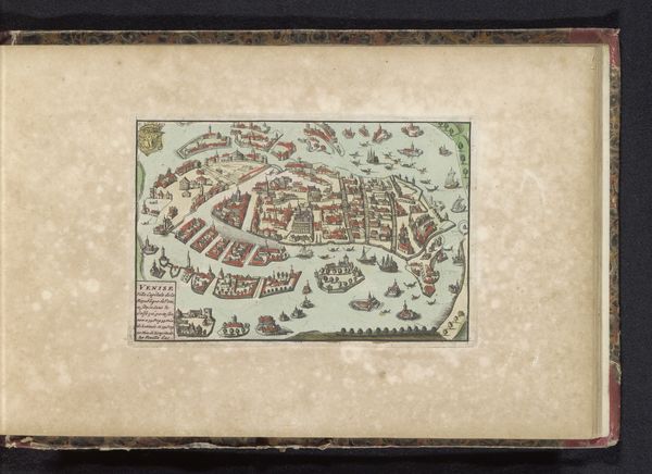
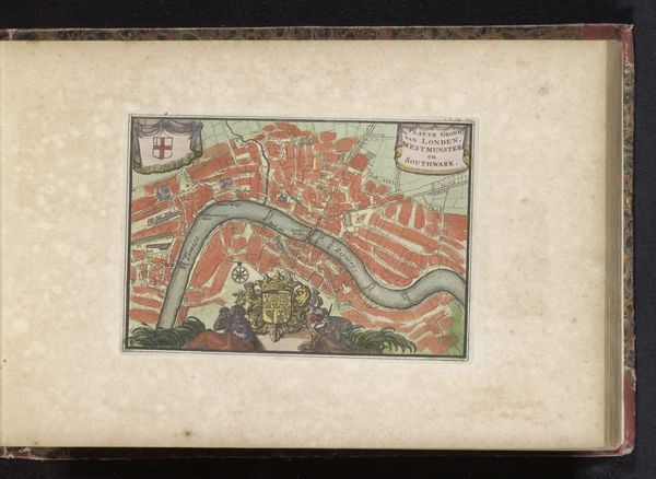
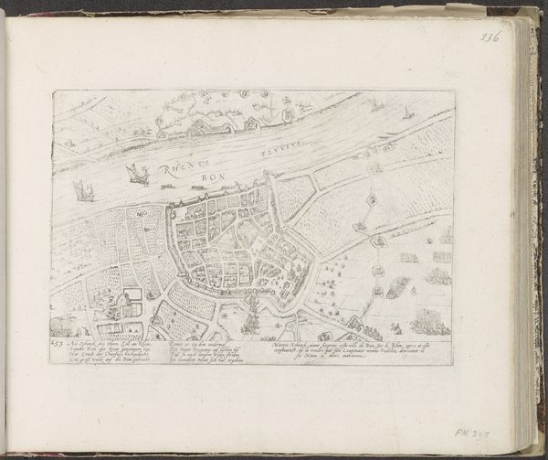
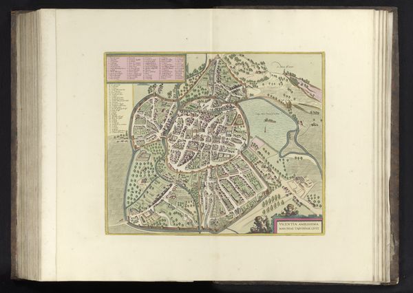
Curator: Let’s discuss this detailed “Plattegrond van Florence,” a cityscape rendered between 1700 and 1735 by an anonymous artist. The drawing combines ink and coloured pencil on paper, exhibiting characteristics of the Baroque period. Editor: It’s intriguing. At first glance, it feels like a constrained representation. The tightly packed structures, rendered in a limited palette of reds, greens, and blues, create a sense of enforced order. Curator: Yes, notice how the lines dictate the composition, dividing the plane into geometric blocks. There is an emphasis on linear precision—observe how each building is reduced to its most essential form. Semiotically, these lines and shapes work together to depict the city, even if it veers towards abstraction. Editor: But what kind of “order” is being represented here? This wasn’t simply urban planning; this map participated in consolidating power. Aristocratic patrons throughout the Baroque period exerted influence, demanding cities visually conform to the tenets of political order and power structures. It’s interesting to see how even maps of this period were forms of state propaganda. Curator: A persuasive reading. However, it’s worthwhile to appreciate the colour at play. The consistent reds contrasted against soft greens—what does this tonal division communicate about urban space, as distinct from natural surrounds? Editor: Those same red blocks signal zones of wealth and influence amid a growing urban population enduring dire conditions. The relationship between the artist, the ruling classes and their subjects needs interrogation—it represents the unequal access to resources and the lived experiences between the people within that ‘grid’. What freedoms and liberties did a “structured life” truly offer them? Curator: We diverge, clearly. The artist’s precise application across the drawing deserves note. A technical command is demonstrable, I find. Editor: Of course! Technical ability allowed the artist to accurately depict the vision held by a governing class; but technical artistic skill doesn't always indicate or imply an egalitarian goal. Curator: Ultimately, analyzing the composition from a structuralist viewpoint clarifies the work's formal arrangement—lines creating forms to denote objects and spatial arrangements. Editor: Agreed, there are multiple entry points to a work, particularly those interwoven with social and historical forces shaping the landscape. That is the real legacy of an artwork like this; power expressed in city planning, then rendered into an aesthetic document.
Comments
No comments
Be the first to comment and join the conversation on the ultimate creative platform.
More like this