print, ink, engraving
#
pen and ink
#
dutch-golden-age
# print
#
ink line art
#
ink
#
geometric
#
cityscape
#
engraving
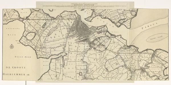
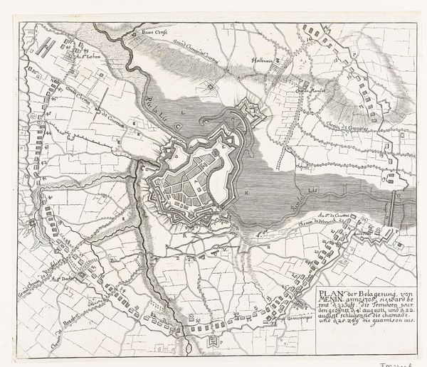
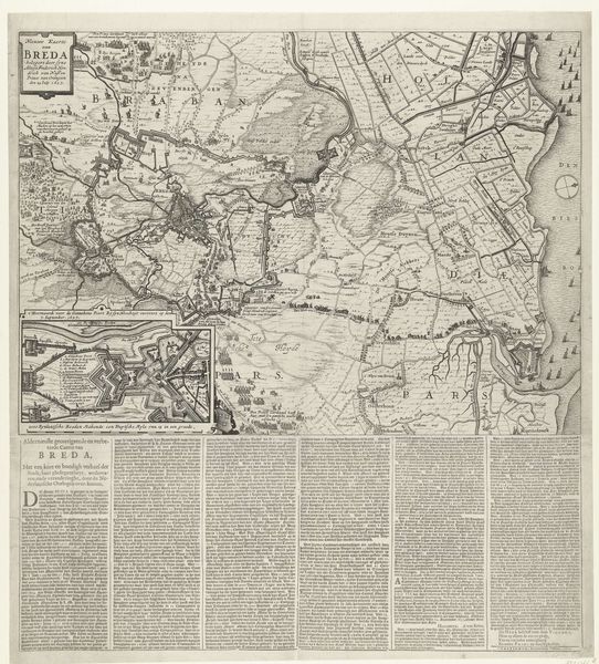
Dimensions: height 522 mm, width 572 mm
Copyright: Rijks Museum: Open Domain
Daniël Stopendaal made this map of Amsterdam and its surrounding areas using engraving techniques. This wasn't just about representing space; it was about shaping it. Look closely at the lines etched into the paper, forming canals, roads, and polders. These weren't just geographical features, they were arteries of commerce, pathways for goods and capital to flow through Amsterdam. The technique of engraving itself mirrors this process. Each precise line is carved out by hand with labor, mirroring the meticulous engineering of Amsterdam's landscape. The city's growth was intrinsically linked to its ability to control and manipulate its environment, reclaiming land from the sea and transforming it into a hub of global trade. This map isn't just a depiction of a place; it's a testament to the ambition and ingenuity that drove Amsterdam's rise as a major economic power. By focusing on the material processes behind it, we can begin to understand the broader historical and social forces that shaped both the map and the city itself.
Comments
No comments
Be the first to comment and join the conversation on the ultimate creative platform.
More like this