print, paper, engraving
#
aged paper
# print
#
old engraving style
#
landscape
#
paper
#
ancient-mediterranean
#
history-painting
#
engraving
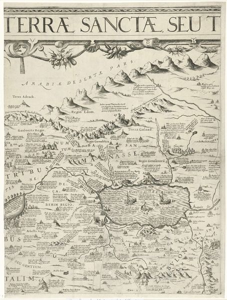
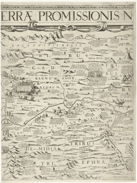
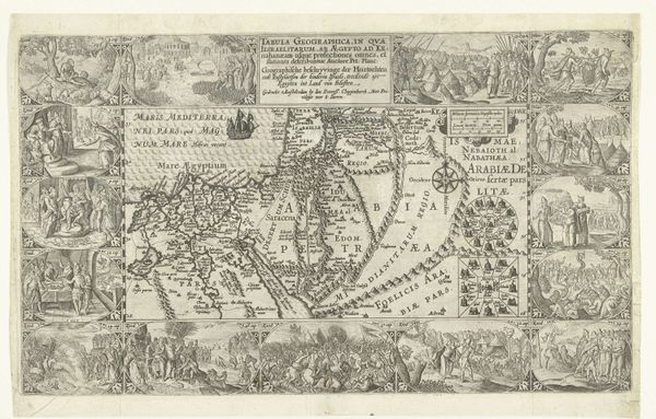
Dimensions: width 415 mm, height 548 mm
Copyright: Rijks Museum: Open Domain
Editor: So, this is "Kaart van Palestina" from 1621, made by Nicolaes van Geelkercken. It's an engraving on paper, a printed map, really. It gives off this wonderfully archaic feel. The landscape looks almost like a fairytale illustration, you know? What strikes you most about this piece? Curator: Oh, my dear, what *doesn't* strike me? Maps like this are less about geographical accuracy, and more about conveying a worldview. Imagine someone in the 17th century, perhaps with the bible in hand, gazing upon this. Each mountain, each town – Bethlehem, Jericho…they would have seen biblical stories unfolding. Notice how the landscape is populated not just with physical features, but also with tiny texts describing the territories. Almost as though knowledge itself were a form of topography. Editor: That makes sense! The writing feels very integrated into the image itself, it’s part of the texture, but did cartographers typically think this way at that time? Curator: Not all of them. Some focused purely on navigation, but Geelkercken seems interested in something more. This "Kaart" is, after all, a ‘description’ of the area. It suggests an intention to represent not just the ‘what’ but also the ‘why’ and perhaps even ‘how one should feel about it.’ Do you feel that? It's a history painting using geography as its medium. I feel it in the flourishes he gives the hills, and the deliberate choices that lend significance to locations and even the typeography he used.. Editor: That’s fascinating, I never considered a map could tell a story in such a way. Thank you for opening my eyes to how meaning can be layered into every line and label! Curator: The pleasure was all mine. May your journeys, both real and imaginative, be as richly layered!
Comments
No comments
Be the first to comment and join the conversation on the ultimate creative platform.
More like this