print, engraving
baroque
geometric
cityscape
engraving
Dimensions: height 438 mm, width 558 mm
Copyright: Rijks Museum: Open Domain
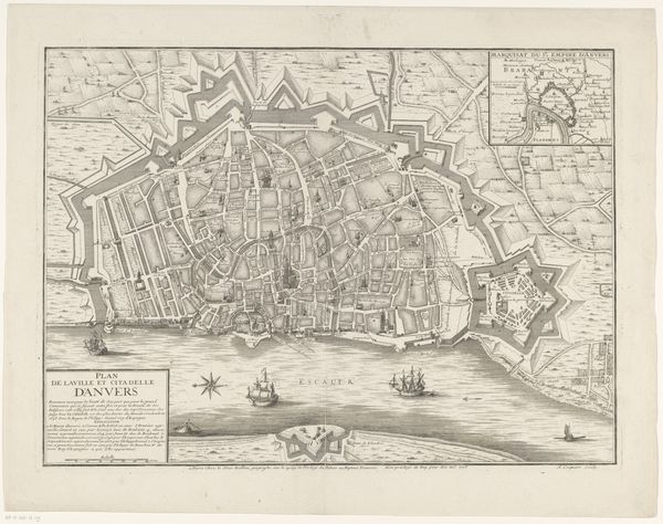
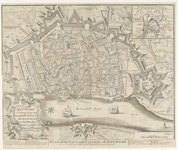
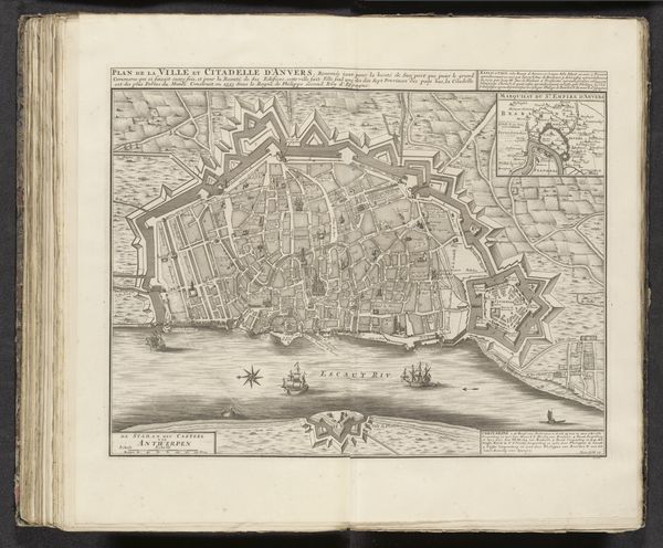
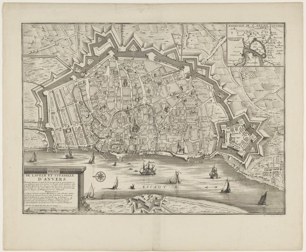
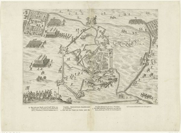
This is Abraham Jansz. Deur's detailed engraving of "Plattegrond van Antwerpen en de Citadel." At first glance, the composition is dominated by a complex network of lines and shapes defining the city's infrastructure and fortifications. Note how the city’s walls, rendered with sharp, angular lines, contrast with the organic, flowing lines of the river. The city and its surroundings are meticulously structured and presented almost mathematically. Deur’s work reflects the broader philosophical and political concerns of his time. Cities were increasingly seen as strategic entities. The visual ordering of space also signifies the imposition of power and control over the urban environment, typical of the era's socio-political landscape. Consider how this map not only represents space, but actively constructs a view of order and power. This cartographic representation serves as both a tool for navigation and a symbol of authority.
Comments
No comments
Be the first to comment and join the conversation on the ultimate creative platform.