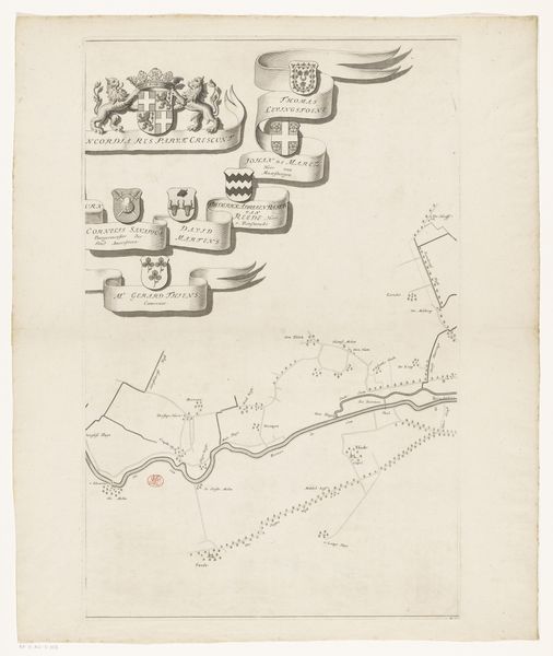
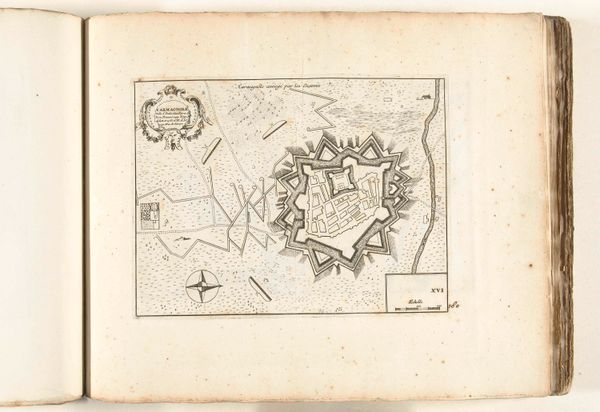
drawing, paper, ink, engraving
#
drawing
#
pen sketch
#
landscape
#
river
#
paper
#
ink
#
engraving
Dimensions: height 617 mm, width 404 mm
Copyright: Rijks Museum: Open Domain
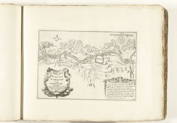
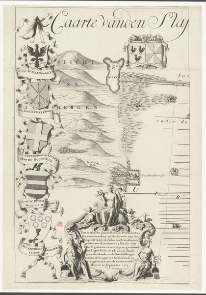
Editor: This is “Kaart van de rivier de Eem (eerste deel),” or "Map of the River Eem (first part)," created by Thomas Doesburgh in 1692. It's an ink and engraving drawing on paper, housed at the Rijksmuseum. Looking at this, the precise lines and organized composition really strike me. It feels very technical and meticulously rendered. What aspects of this piece grab your attention? Curator: Immediately, it is the dialectic between precision and abstraction. The map's function is explicitly representational, but observe how Doesburgh employs line weight and density. See how he uses the variations in linework to denote topographical features versus political demarcations. What semiotic system can we decipher from this interplay? Editor: It’s almost like he's creating a visual language with the line itself! The varying thicknesses help distinguish, say, a settlement from a geographical boundary, wouldn't you agree? Curator: Precisely! Consider, also, the visual weight. The ribbons displaying family crests aren't functionally related to the river's course. Yet, they occupy considerable space, diverting the viewer’s eye. Does this not shift the piece away from pure functionality, inviting subjective, even aesthetic contemplation? Is the artist commenting on the influence and prestige of these families on the River Eem and its traffic? Editor: That's a perspective I hadn't considered! It reveals a power dynamic literally mapped into the landscape. So, the artwork functions beyond just being informative; it also visually represents a hierarchy. Curator: Yes. Ultimately, the essence of the map is in its articulation, and Doesburgh’s orchestration of graphic elements to give the visual effect more volume and depth. This allows us to gain insight and form opinions regarding the map as a diagrammatic code for social structures. Editor: This deepens my understanding, it’s not just about location, but layers of meaning communicated through visual language. Curator: Indeed; an appreciation of pure line becomes an appreciation for more complex realities.
Comments
No comments
Be the first to comment and join the conversation on the ultimate creative platform.
More like this