print, paper, engraving
#
baroque
#
dutch-golden-age
# print
#
pen illustration
#
old engraving style
#
landscape
#
paper
#
cityscape
#
engraving
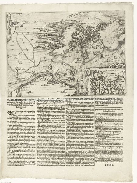
Dimensions: height 450 mm, width 376 mm
Copyright: Rijks Museum: Open Domain
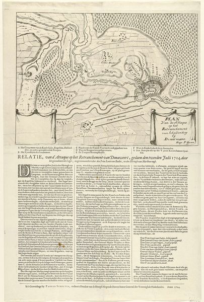
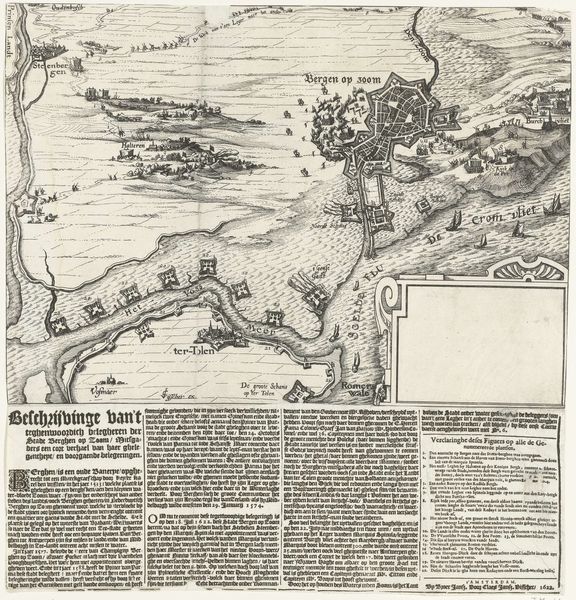
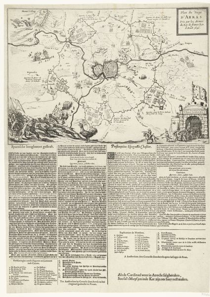
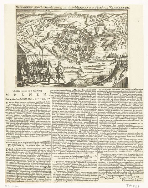
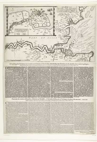
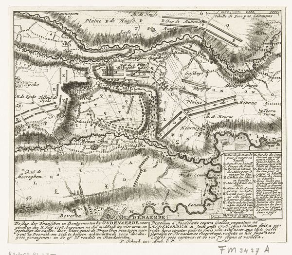
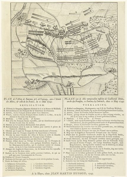
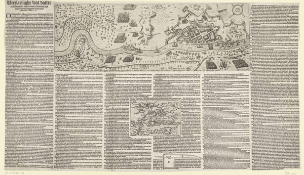
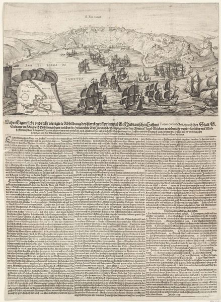
This is an anonymous print made in 1643, depicting the siege of Thionville. During the early modern period, maps of sieges were made not only to record military history but also to shape public opinion. It was a way of communicating news and also reinforcing political viewpoints. The image presents the town of Thionville as a highly structured and heavily fortified space. Produced in the Netherlands during the Dutch Golden Age, this map reflects the cultural and economic interests of the time. The Dutch Republic was a major center for cartography and printmaking, and this map exemplifies the institutional structures that helped to shape the production and consumption of images during this period. The detailed rendering of military positions suggests a high degree of technical skill and a commitment to accuracy, reflecting the importance of strategic information in a time of intense political and military competition. To understand this print better, we can consult historical archives and military records to uncover the full context.
Comments
No comments
Be the first to comment and join the conversation on the ultimate creative platform.
More like this