drawing, print, etching
#
drawing
#
baroque
# print
#
etching
#
cityscape
#
watercolour illustration
Dimensions: height 105 mm, width 151 mm, height 532 mm, width 320 mm
Copyright: Rijks Museum: Open Domain
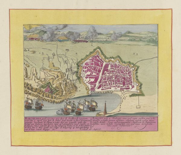
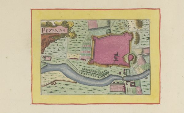
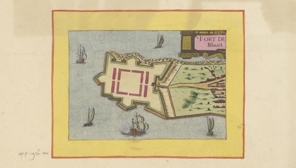
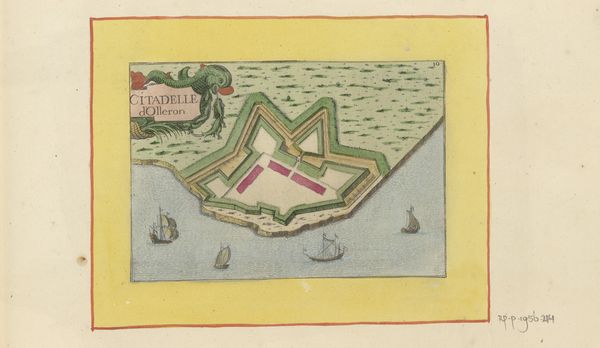
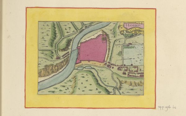
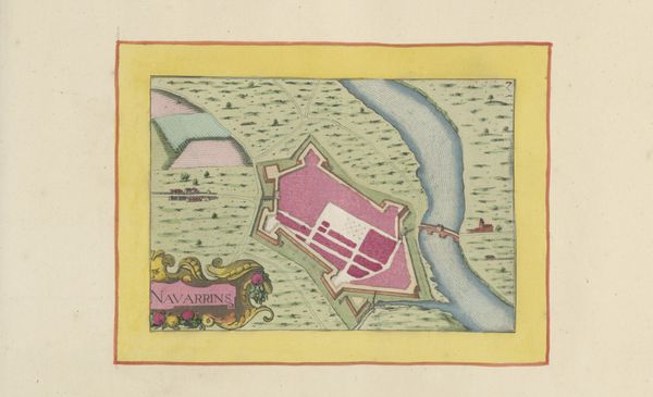
Editor: This etching from 1638, "Plattegrond van Bourg," whose author is currently unknown to us, offers a bird’s-eye view of the town of Bourg. I’m really struck by how orderly everything seems. The composition feels so deliberately structured and the pink is… unexpected! What can you tell me about it? Curator: The pink, ah yes! It’s arresting, isn’t it? Imagine stumbling upon Bourg as a traveler in those days! It’s all speculation now. This piece is more than just a record. It’s about power, control, and even… dreams! Consider how the rigid city plan contrasts with the unpredictable natural world just outside its walls. What do you make of that contrast? Editor: I guess I didn't really clock it as contrast at first... So you mean how the town looks very controlled with neat borders and then around the walls, the etching has rougher terrain and unorganized plants? Almost like order versus nature, kind of a civilization type-thing. Curator: Precisely. I'd encourage us not to reduce those themes to basic terms, though! This map projects the ambition to impose order on chaos, a signature theme of the Baroque. Think of the gardens of Versailles— nature bent to human will! Isn't it interesting how even something seemingly straightforward, like a town map, becomes a stage for such grand philosophical questions? I suppose I look for these "staging" effects now. How does the "staging" of the harbor scene, for example, make you feel? Editor: Hmmm...Staging. The harbor feels isolated... and there aren't even many people in the whole frame! That contrast helps create the picture's story. I wouldn't have realized the map shows how humans saw the world then! Thanks! Curator: Anytime! Just consider, perhaps it's just humans imagining how humans wanted to see the world. Perspective matters!
Comments
No comments
Be the first to comment and join the conversation on the ultimate creative platform.
More like this