print, engraving
#
baroque
# print
#
old engraving style
#
cityscape
#
engraving
Dimensions: height 280 mm, width 318 mm
Copyright: Rijks Museum: Open Domain
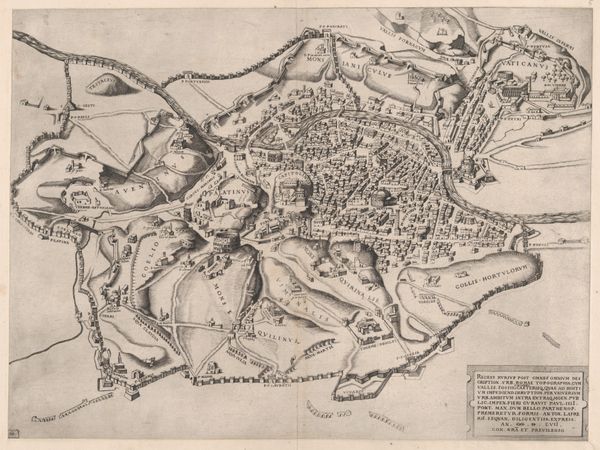
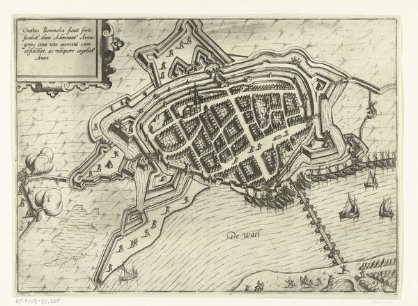
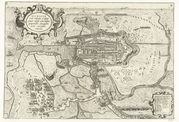
Curator: Welcome. Today, we're looking at Matthäus Merian’s "Kaart van Valletta," created in 1636. It's currently held at the Rijksmuseum. Editor: My immediate impression is one of tightly packed precision. Look at how methodically the town is rendered. It feels almost like a blueprint, evoking ideas of military strategy and civic order. Curator: Exactly. Merian’s expertise really shines through in the graphic rendering of space. Notice the use of perspective, how it’s simultaneously bird’s-eye and yet also gives dimension to individual structures. The very material—the engraved lines—emphasizes a controlled, almost architectural sensibility. Editor: And those fortress-like corners! This city is dominated by fortifications. The symbol of an unwavering defense echoes a very real historical reality: Valletta as a bastion against the Ottoman Empire. That lower right corner is interesting too, with what appears to be the compass rose positioned next to the island map, reinforcing the symbolic ties between navigation, conquest, and knowledge. Curator: The details reinforce the overall structure of Baroque visual grammar: a display of calculated, rational planning. Look how the details work, how buildings create this dense accumulation of form and create rhythm from corner to corner of the walled region. This is about control and legibility above all else. Editor: But is there perhaps a tension here? While the map is obviously about strategic advantage, could we also see an echo of the mythical in that stylized cartouche framing the island? After all, maps were often seen as embodying a place's essence or spirit. Curator: That’s a valid observation, however, such imagery also functions as ornamentation, another element in the controlled arrangement of elements typical for its era. Editor: True, true. This rendering, with its angular fortresses and geometric street plan, projects a feeling of resilience. It offers us insights into both urban planning and the mindset of 17th century Europe. Curator: A testament to the persuasive power of carefully rendered lines and forms. Editor: Precisely—where cultural and aesthetic meet and merge!
Comments
No comments
Be the first to comment and join the conversation on the ultimate creative platform.
More like this