print, etching, engraving
#
baroque
# print
#
etching
#
etching
#
cityscape
#
engraving
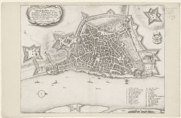
Dimensions: height 375 mm, width 520 mm
Copyright: Rijks Museum: Open Domain
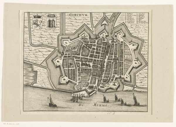
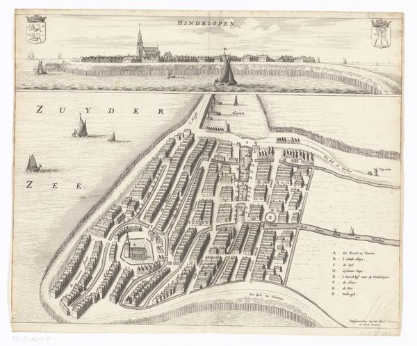
Matthäus Merian created this detailed map of Toruń in the 17th century using etching and engraving. The bird's-eye view presents Toruń, now in Poland, as a fortified city, reflecting its strategic importance within the Polish-Lithuanian Commonwealth. The meticulous depiction of the city's layout, complete with its defensive walls and grid-like street plan, speaks to the period's emphasis on urban planning and military preparedness. Merian's work aligns with the broader cultural project of mapping and documenting European cities, driven by both scientific curiosity and the needs of statecraft. The map not only served practical purposes but also contributed to a sense of civic pride and identity. Understanding this artwork involves delving into the history of cartography, urban development, and the socio-political context of 17th-century Poland. Maps were not just neutral representations of space; they were tools of power and knowledge.
Comments
No comments
Be the first to comment and join the conversation on the ultimate creative platform.
More like this