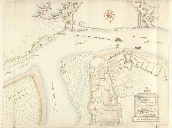
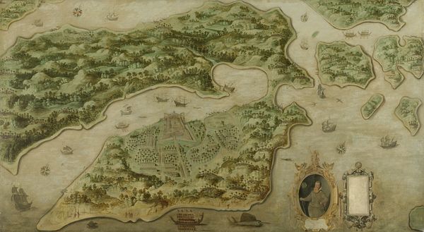
Plattegrond van het eiland Dieuw of Diewij aan de Koromandelkust, India 1675 - 1725
0:00
0:00
drawing, paper, watercolor
#
drawing
#
water colours
#
asian-art
#
landscape
#
paper
#
watercolor
#
coloured pencil
Dimensions: height 53.5 cm, width 75 cm, height 61.3 cm, width 83.8 cm
Copyright: Rijks Museum: Open Domain
This is a hand-drawn map of Dieuw Island on the Coromandel Coast of India, created by an anonymous artist. It offers us a glimpse into the complex interplay of trade, exploration, and colonialism that shaped the 17th and 18th centuries. The map, with its decorative birds and compass rose, uses visual codes familiar to European audiences, yet depicts a land far removed from Europe. The detailed rendering of the island’s topography and settlements suggests a practical purpose, likely related to trade or military strategy. The Dutch East India Company, or VOC, dominated trade in this region at the time. Maps like this served as tools of empire, enabling the VOC to exert control over vast territories and populations. By studying archival documents, trade records, and the personal accounts of VOC employees, we can begin to understand the social conditions that shaped its production, and reflect on the ways in which cartography can be used to assert power and legitimize colonial ambitions.
Comments
No comments
Be the first to comment and join the conversation on the ultimate creative platform.
More like this