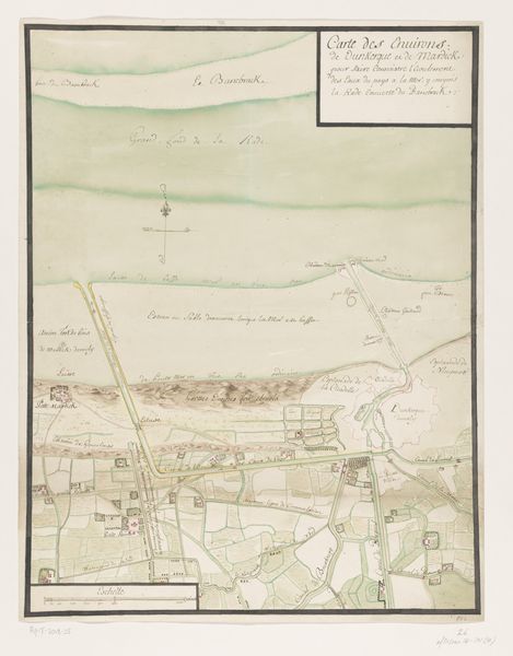
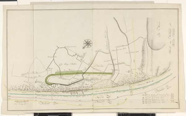
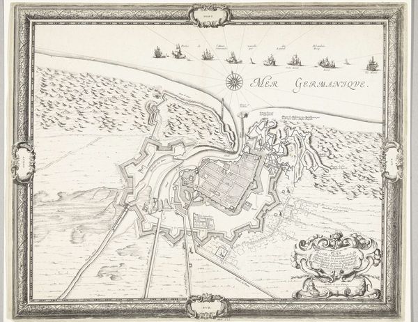
Plattegrond van de schansen ten noorden van Duinkerke, ca. 1701-1715 1706
0:00
0:00
drawing, paper, ink
#
drawing
#
baroque
#
landscape
#
paper
#
ink
#
history-painting
Dimensions: height 403 mm, width 520 mm
Copyright: Rijks Museum: Open Domain
Samuel Du Ry de Champdoré created this map of the fortifications north of Dunkirk sometime between 1701 and 1715. It offers a glimpse into the intense political and military strategies that shaped 18th-century Europe. Champdoré, a military engineer, meticulously details the landscape around Dunkirk, a strategically important port city. His map isn't just a geographical representation; it's a document of power, outlining the lines of defense that were so critical in an era defined by territorial disputes and war. Look closely, and you can see how land and identity are intertwined. The fortifications, with their complex network of moats and walls, are more than just structures. They are embodiments of the era's anxieties, reflecting the constant threat of invasion and the ever-shifting boundaries of nations. This map encapsulates the tensions of a world where control over land meant control over people and resources. It reminds us of the human cost embedded in every line and carefully drawn boundary.
Comments
No comments
Be the first to comment and join the conversation on the ultimate creative platform.
More like this