print, paper, engraving
#
baroque
#
dutch-golden-age
# print
#
paper
#
cityscape
#
engraving
Dimensions: height 172 mm, width 216 mm
Copyright: Rijks Museum: Open Domain
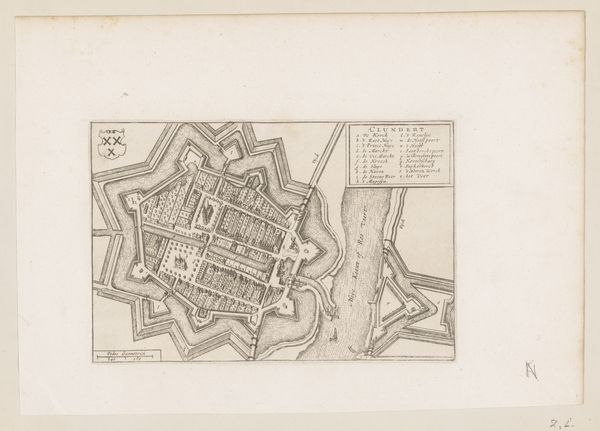
This is an anonymous, undated map of Tholen in Zeeland. The town is encased by a striking star-shaped fortress. This design wasn't merely aesthetic. It reflects a period of intense conflict and defense strategy. The star fort, or "trace italienne," emerged in the 15th century as a response to the increasing use of gunpowder artillery. Its angled bastions allowed for the coverage of all angles, eliminating blind spots and deflecting cannon fire. We see echoes of this design throughout Europe, in the fortifications of cities like Palmanova in Italy. The star shape may also possess deeper psychological roots. Stars have symbolized protection and guidance across many cultures. Subconsciously, the star fort might evoke a sense of security. Over time, the evolution of this symbol has seen it become a symbol of fortification, later adapted and reinterpreted to meet new challenges. This isn't just a map; it's a cultural artifact, where military strategy meets symbolism. It is part of a cyclical progression, where old ideas are constantly reborn in new forms, charged with new meaning.
Comments
No comments
Be the first to comment and join the conversation on the ultimate creative platform.
More like this