drawing, print, paper, engraving
#
drawing
#
aged paper
#
toned paper
#
ink paper printed
# print
#
landscape
#
paper
#
geometric
#
line
#
engraving
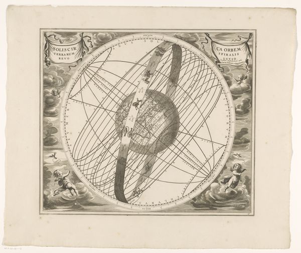
Dimensions: height 186 mm, width 230 mm
Copyright: Rijks Museum: Open Domain
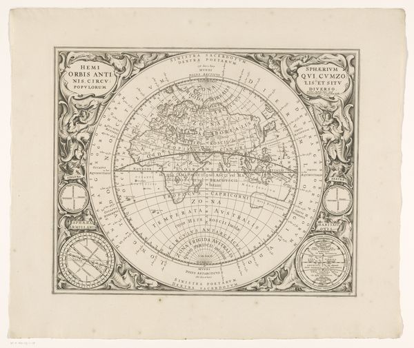
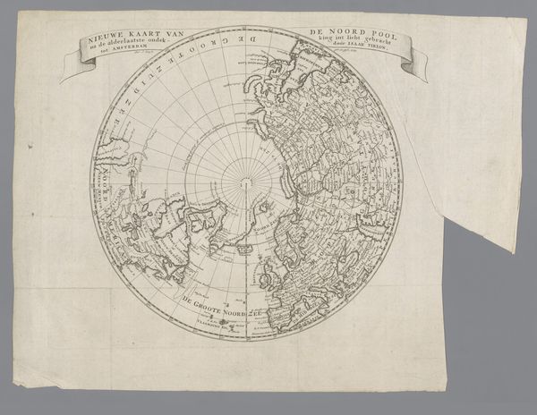
Editor: This is "Wereldkaart," or World Map, from 1774. It’s an engraving on paper. I’m immediately struck by how utilitarian it appears, like a blueprint almost. How would you interpret this piece? Curator: Utilitarian is a good word. Let’s think about the materiality itself: paper, ink, engraving. These were readily available materials in the 18th century, part of a growing print culture tied to trade and colonialism. Consider the labor involved in producing this. Do you think that influences its purpose beyond just geographical representation? Editor: Definitely. The precision of the lines suggests mass production. Maybe it speaks to the Dutch Republic’s aspirations to map and therefore control resources. Curator: Exactly! It’s less about artistic expression, more about dissemination of information. The value wasn't in the individual artistry but the function, tied directly to the mercantile interests of the time. Look at the detail of shipping routes versus the simplification of the landmasses. What does *that* prioritize? Editor: That highlights trade and exploration, and maybe a specific consumer that needs that data. Was it intended for individuals, merchants, shipping industry? Curator: Likely merchants, navigators, those directly involved in expanding trade routes. It’s a tool, and the print medium made that tool accessible. Now, consider how hand-drawn maps, with their artistic flourishes, served a different social function… Editor: This perspective really shifts my understanding. It’s not just a map, it's about power, labor and mass production of geographical information in the service of commerce. Curator: Precisely. Looking at art through its materials and production reveals so much about the society that created it.
Comments
No comments
Be the first to comment and join the conversation on the ultimate creative platform.
More like this