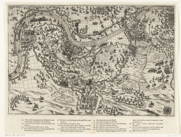
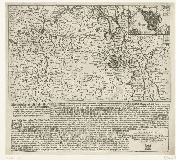
Militaire campagnes van Maurits en Spinola in Overijssel en Zutphen, 1606 1606
0:00
0:00
baptistavandoetechum
Rijksmuseum
graphic-art, print, engraving
#
pen and ink
#
graphic-art
#
dutch-golden-age
# print
#
old engraving style
#
pen work
#
history-painting
#
engraving
Dimensions: height 353 mm, width 374 mm
Copyright: Rijks Museum: Open Domain
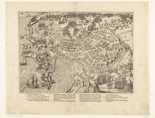
This map of the military campaigns of Maurits and Spinola in Overijssel and Zutphen, was printed in 1606 by Baptista van Doetechum. It’s an engraving, made by cutting lines into a copper plate, inking it, and pressing it onto paper. This was a highly developed technology by the 17th century, a crucial means for disseminating information and shaping public opinion. Consider the level of craft involved. The map is incredibly detailed, showing troop movements, fortifications, and the lay of the land. Cartographers like van Doetechum were highly skilled technicians, able to translate complex data into visual form. The map would have been made using specialized tools, including burins for cutting lines, and presses for transferring the image to paper. This wasn’t just an aesthetic object; it was a functional one. It provided military leaders and citizens alike with a visual understanding of the conflict. Maps like this one played a crucial role in shaping the course of war and politics. Looking closely, we see that even something seemingly documentary like a map is the product of intense labor, skilled making, and a specific social context.
Comments
No comments
Be the first to comment and join the conversation on the ultimate creative platform.
More like this