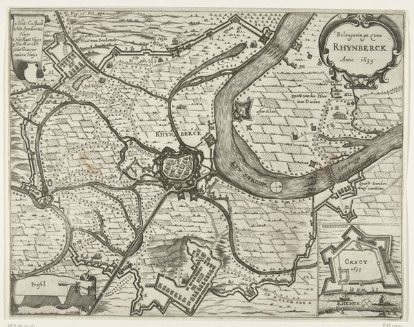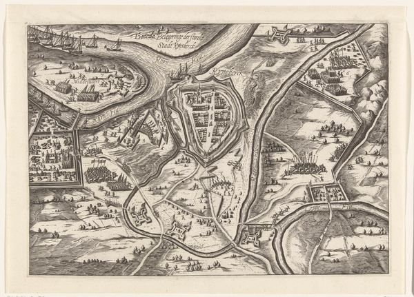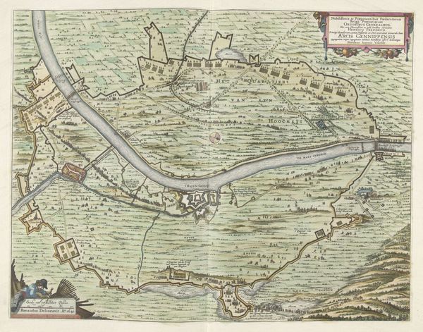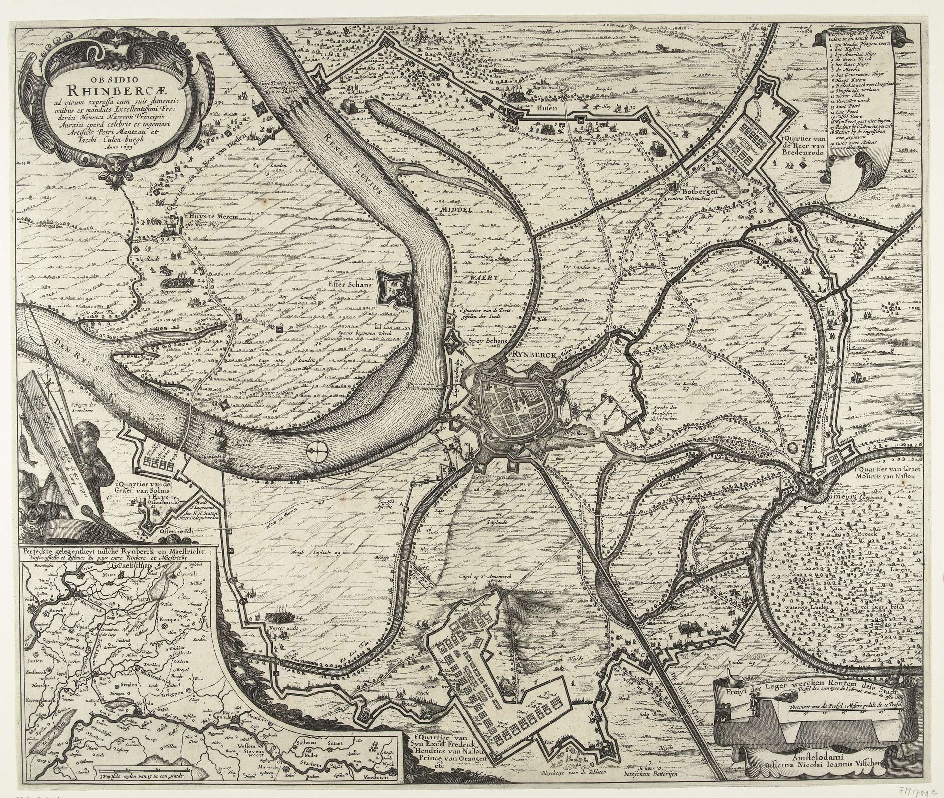
1633
Kaart van de verovering van Rijnberg, 1633
Claes Jansz. Visscher
1586 - 1652Location
RijksmuseumListen to curator's interpretation
Curatorial notes
Editor: Here we have Claes Jansz. Visscher's "Kaart van de verovering van Rijnberg, 1633," created in 1633. It's currently held at the Rijksmuseum. Looking at this pen drawing, I’m struck by the incredible detail. It feels almost like a photograph, but hand-drawn. What historical context am I missing? Curator: This isn't just a drawing; it's a powerful piece of political propaganda. These detailed maps served to communicate and celebrate military victories to a wide audience. How do you think the general public received such imagery at the time? Editor: I imagine with a sense of pride, perhaps even inspiration, if the "home team" won the portrayed battle. It seems like today's newsreels or patriotic social media posts? Curator: Exactly. Now, consider the role of the Rijksmuseum today. How does displaying a piece like this contribute to our understanding of Dutch identity and history? Is it a neutral act, or does it perpetuate certain narratives? Editor: That's a complex question. On the one hand, it educates us about the past. On the other, presenting only triumphant accounts risks creating a selective and potentially skewed historical memory. Whose story is *not* being told, right? Curator: Precisely! Who commissioned this piece, and what was their intention? This map functions less as an objective record and more as a carefully constructed narrative of Dutch military prowess. The precise details reinforced the perception of Dutch control and superiority. Editor: That is an interesting distinction. Seeing it as more of a narrative, I now wonder about the map maker and their relationship to the conflict. Curator: Food for thought indeed! By analyzing the imagery within its social and political framework, we can start to see the true complexities of such a visual source. Editor: This really changes my view! I thought I was looking at a simple map, but it is clear there are many other underlying messages. Curator: These maps played a critical role in shaping public opinion and solidifying the political power of the Dutch Republic. Considering it this way adds a layer of appreciation to Visscher's piece!