graphic-art, print, engraving
#
graphic-art
#
baroque
# print
#
geometric
#
history-painting
#
engraving
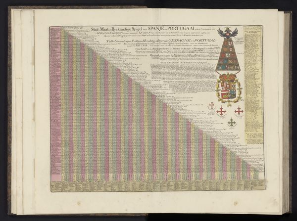
Dimensions: height 430 mm, width 560 mm
Copyright: Rijks Museum: Open Domain
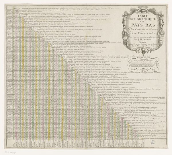
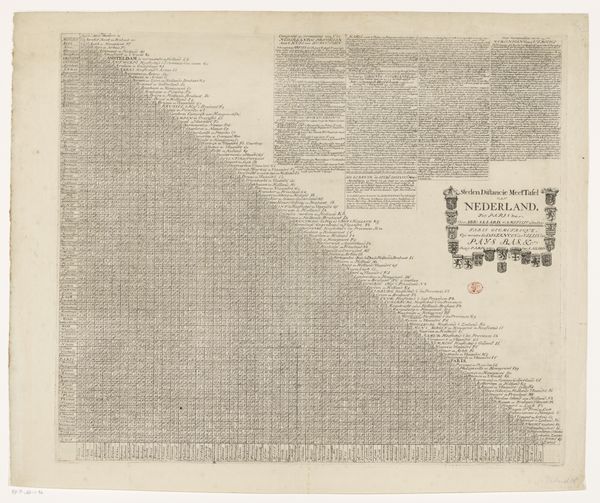
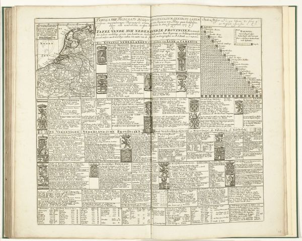
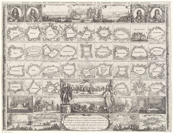
Abraham Allard created this distance chart of Spain and Portugal in 1726 using etching. The chart is dominated by a grid-like structure, meticulously filled with place names and distances, creating a complex visual pattern. The rigid geometry contrasts sharply with the decorative heraldic elements adorning the right side. The visual tension established by the ordered grid and heraldic display invites us to consider how Allard’s work functions as more than a mere logistical tool. The table presents a semiotic system in which each intersection within the grid represents a fixed spatial relationship, a measurable ‘truth’. Yet, the addition of heraldic symbols introduces a layer of cultural and political coding. Consider how the stark practicality of the grid collides with the symbolic weight of heraldry, reflecting the intersection of rational cartography and ideological representation in the early 18th century. The etched lines, therefore, do not simply map distances, but also chart the contours of power and knowledge.
Comments
No comments
Be the first to comment and join the conversation on the ultimate creative platform.
More like this