drawing, ink, pen, engraving
#
drawing
#
baroque
#
pen drawing
#
pen illustration
#
pen sketch
#
landscape
#
ink line art
#
ink
#
pen-ink sketch
#
pen
#
cityscape
#
history-painting
#
engraving
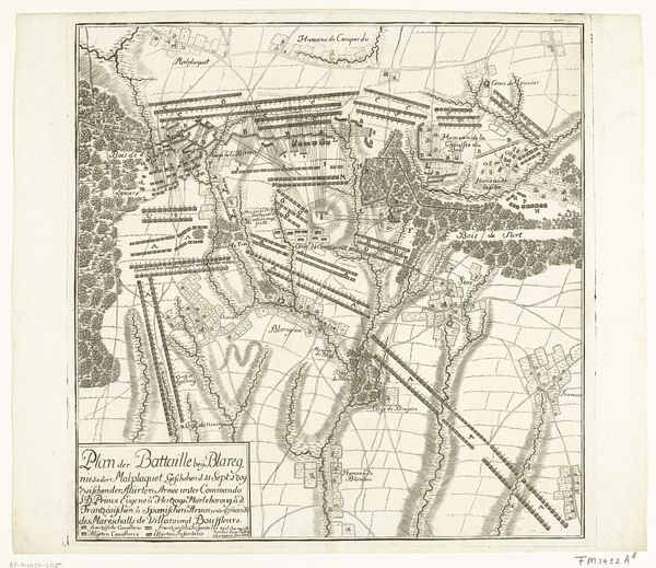
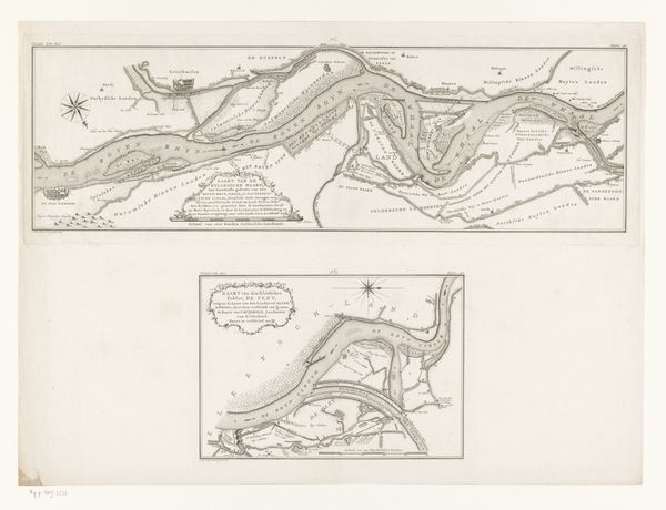
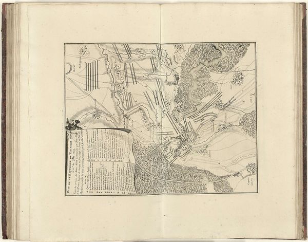
Dimensions: height 655 mm, width 923 mm
Copyright: Rijks Museum: Open Domain
Jan van Vianen created this etching, "Kaart van de Slag bij Höchstädt," in 1704, offering a detailed visual representation of the battle. The monochromatic palette focuses the viewer's attention on the linear elements and spatial arrangement. Notice the upper half is dominated by open landscapes and meandering lines of rivers and paths, contrasted with the lower half's dense formations indicating troop deployments. The linear precision is striking. Lines meticulously define topographical features and military positioning, creating a structured yet dynamic composition. This etching does more than simply depict a historical event; it interprets and organizes space through symbolic representation. Consider the map's semiotic function. Each line, shape, and symbol communicates strategic information, transforming the battlefield into a readable text. Van Vianen's formal choices effectively convey power structures and spatial relationships, inviting the viewer to decode the complex choreography of war. The calculated precision destabilizes any romantic notions of battle. Ultimately, this etching is a complex interplay of form and function, reflecting the Enlightenment’s emphasis on reason and order.
Comments
No comments
Be the first to comment and join the conversation on the ultimate creative platform.
More like this