graphic-art, print, engraving
#
graphic-art
# print
#
old engraving style
#
landscape
#
cityscape
#
history-painting
#
engraving
Dimensions: height 248 mm, width 359 mm
Copyright: Rijks Museum: Open Domain
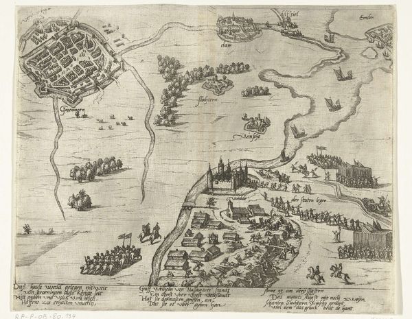
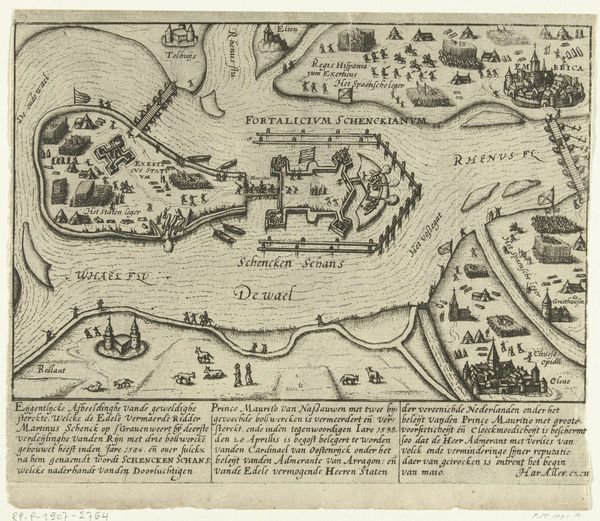
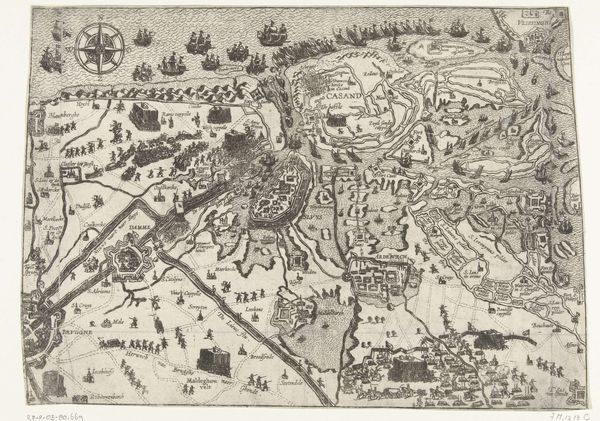
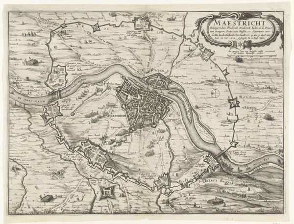
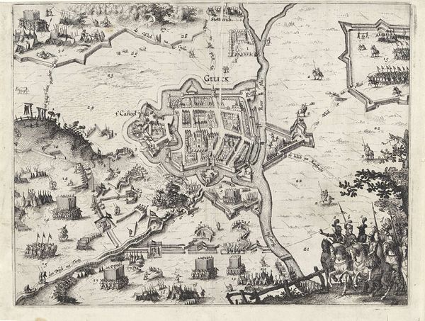
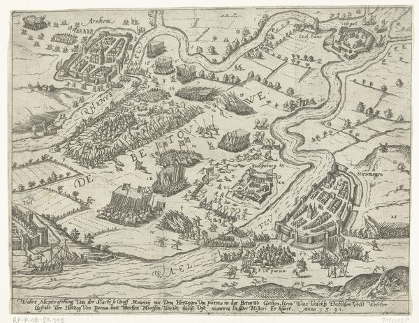
This detailed depiction of the battle in the Bommelerwaard in 1599, rendered by an anonymous hand, presents a bird's-eye view brimming with symbolic import. Note the array of encampments and fortifications; they are more than mere military dispositions. They are visual testaments to the enduring human impulse to demarcate, to control, and to defend. These shapes and structures evoke ancient notions of territory and power echoing through time. Consider the labyrinthine layout of Bommel itself. This tightly knit configuration of walls and buildings mirrors the complex, often impenetrable nature of human society. One can trace similar patterns in ancient city plans across civilizations, from the fortifications of Jericho to the urban designs of the Roman Empire. This recurring motif of enclosure speaks to a collective desire for security, a yearning that persists in our subconscious. The emotional weight of this map lies not just in its historical accuracy but in its capacity to awaken ancestral memories of conflict and resilience, a powerful force engaging viewers on a deep, subconscious level.
Comments
No comments
Be the first to comment and join the conversation on the ultimate creative platform.
More like this